Skip to content
Ecological Intelligence

Ecological evidence.
Independent perspective.
Explore Wild Lands ↗

Morning Brief Global edition

September 28, 2026 · Issue 018

Today’s strongest signal is that ecological stress does not travel through systems in a straight line. Atmospheric drying becomes very different river-flow drought from catchment to catchment; Arctic parasite infections become visible because Indigenous surveillance catches syndromes that routine monitoring could miss; a centuries-old herring collapse reads differently once climate, fishing and socioeconomic feedbacks are modeled together; and dryland mine recovery improves when separate limitations are treated as separate design problems. Across restoration, cities, fire and working lands, the useful question is not just whether pressure increased, but how the system transformed that pressure before it reached the outcome managers care about.

Land Manager Watch

Evidence for decisions on land, water and habitat

Peer-reviewed long-term prescribed-fire experiment · Dry ponderosa pine forest, western United States

Short burn intervals reduced fuels most—but also reduced some understory wildlife values

A long-term ponderosa-pine experiment found five-year prescribed-fire intervals strongest for limiting litter and shrubs, while longer intervals retained more of some wildlife-useful understory structure.

Management read

For managers, return interval is an objective tradeoff rather than a single optimum. Frequent fire can favor fuel-reduction goals, while somewhat longer or spatially varied intervals may preserve more understory habitat. A mosaic of burn histories may therefore be more useful than imposing one landscape-wide interval when fuels and wildlife objectives both matter.

Caveat / uncertainty: Results come from a dry ponderosa-pine system with its own fire history, soils and understory community. Longer intervals can accumulate fuels and competitive vegetation, and shorter intervals can suppress valued shrubs; the study does not establish one universally correct interval or eliminate the need to adjust timing and intensity to site conditions.

Read the full evidence, caveats & Land Manager analysis →

Editorial thread to watch

Three patterns recur. First, propagation matters: the same external pressure can be attenuated, delayed or amplified by hydrology, food webs, institutions or landscape structure. Second, intervention effects are multi-dimensional: constructed marshes, mine reclamation, estuary reconnection, urban biofilters and oak-savanna treatments improve some functions while leaving other risks or constraints behind. Third, monitoring architecture changes what becomes actionable—from community-led caribou health surveillance and aerosol networks to Landsat wetland indices and multi-stressor marine risk maps. Strong ecological intelligence keeps those pathways, tradeoffs and uncertainty attached to the headline result.

Priority Reads

The evidence that deserves a closer look.

Atmospheric drying is not translating cleanly into river-flow drought
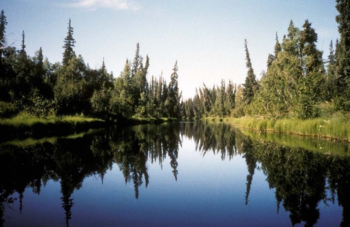
Illustrative image — USFWS; not study-site documentation · Public Domain · Rights: Public domain

Atmospheric drying is not translating cleanly into river-flow drought

Across roughly 19,000 catchments, four decades of atmospheric drying produced far more heterogeneous streamflow-drought trends—showing how catchments can attenuate, delay or amplify climate pressure.

Evidence
Peer-reviewed global observational study
Geography
Global; 18,907 catchments
System
River basins / catchments

WHAT THE EVIDENCE SAYS

Researchers compared atmospheric drought and hydrological drought across 18,907 catchments from 1981–2019. Atmospheric drying showed a broadly coherent shift toward drier conditions, while streamflow drought trends were much more heterogeneous, indicating that catchment storage, routing and other hydrologic processes substantially reshape how climate stress propagates into rivers.

WHY IT MATTERS / OUR READ

Water-risk assessment should not treat an atmospheric drought index as a direct proxy for streamflow drought. The management-relevant signal is the catchment response: similar climate pressure can arrive downstream with different timing, magnitude and persistence, so monitoring and planning need hydrological observations or models calibrated to the basin rather than climate metrics alone.

CAVEATS / UNCERTAINTY

This is a global observational synthesis, not an attribution experiment for every catchment. The record ends in 2019, catchments differ in regulation and data quality, and the study demonstrates nonlinear propagation more clearly than it isolates every local mechanism. It does not provide a universal basin-management prescription.

SOURCE

Nature Water
View original evidence ↗

Read the Wild Lands assessment

Community-based Inuit surveillance detected an emerging caribou disease outbreak

Community-based surveillance in Nunavut documented filarial infections and lesions in barren-ground caribou, showing how Indigenous harvesting networks can extend wildlife-health detection across a rapidly changing Arctic.

Evidence
Peer-reviewed community-based wildlife health surveillance
Geography
Nunavut, Canadian Arctic
System
Barren-ground caribou and Arctic food system

WHAT THE EVIDENCE SAYS

A community-based surveillance program working with Inuit harvesters documented visible lesions and filarial nematodes in harvested barren-ground caribou, including Setaria yehi and Onchocerca lineage 2. The study links local observations, veterinary investigation and molecular identification to characterize syndromes that conventional wildlife-health systems could otherwise miss across a remote landscape.

WHY IT MATTERS / OUR READ

The important result is as much about surveillance architecture as the parasites themselves. Harvesters operate across places and seasons that formal monitoring samples sparsely, so durable community partnerships can create earlier, geographically richer wildlife-health intelligence while keeping observations connected to food security and local knowledge.

CAVEATS / UNCERTAINTY

The observations do not establish a population-wide prevalence trend or prove that climate change caused the infections. Sampling is tied to subsistence harvest rather than a randomized population survey, and the study does not quantify human food-safety risk. Climate sensitivity is a plausible ecological context, not a single demonstrated causal pathway.

SOURCE

Scientific Reports
View original evidence ↗

Read the Wild Lands assessment

A centuries-old herring collapse looks different when climate, fishing and markets are modeled together

A reconstruction of the western Baltic herring fishery around its sixteenth-century collapse points to interacting environmental and socioeconomic pressure rather than a single historical cause.

Evidence
Peer-reviewed historical socioecological reconstruction and modeling
Geography
Western Baltic Sea; Denmark–Sweden region
System
Marine fishery / Baltic herring socioecological system

WHAT THE EVIDENCE SAYS

Researchers reconstructed roughly 450 years of western Baltic herring fishery dynamics from historical records and environmental information. The collapse around the late sixteenth century is best explained as a coupled event in which fishing pressure, environmental variability and socioeconomic forces interacted, rather than by a single climatic or harvesting driver.

WHY IT MATTERS / OUR READ

Historical collapses are useful because they expose feedbacks that short modern records can hide. A fishery can become vulnerable through the interaction of ecology, markets, effort and institutions, so management that isolates stock biology from the socioeconomic system may miss the pathway by which resilience erodes.

CAVEATS / UNCERTAINTY

Historical catch and socioeconomic records are incomplete and require reconstruction, and model structure influences the inferred contribution of individual drivers. The system, technology and governance differ substantially from modern fisheries, so the study informs mechanism and historical perspective rather than supplying a contemporary harvest rule.

SOURCE

Nature Sustainability
View original evidence ↗

Read the Wild Lands assessment

Dryland mine reclamation improved when surface structure, native seeding and biocrust restoration targeted different limits

A five-year Arizona mine experiment found that physical microsites, native seeding and biocrust inoculation affected different pieces of recovery—arguing for treatment packages rather than one restoration lever.

Evidence
Peer-reviewed five-year field experiment
Geography
Kanab North Mine, northern Arizona, USA
System
Dryland mine reclamation / Colorado Plateau

WHAT THE EVIDENCE SAYS

A fully crossed five-year reclamation experiment tested surface-modifying structures, native-only seed and biocrust inoculation at a former uranium mine. Surface structures improved vegetation cover and soil stability, native seeding increased native and perennial cover, and inoculated biocrust persisted most clearly where the surface structures created favorable microsites.

WHY IT MATTERS / OUR READ

The treatments were doing different jobs. That is useful for managers because dryland reclamation often fails when a single intervention is expected to solve establishment, erosion and soil-surface recovery at once. Designing treatment packages around the limiting processes may be more defensible than asking which single treatment 'works.'

CAVEATS / UNCERTAINTY

Results come from one dryland mine setting and five years of recovery. Costs, installation logistics, precipitation sequence and local soils can alter performance, and persistence of biocrust or plant cover does not by itself establish full ecosystem recovery. The study does not imply that every disturbed dryland needs all three interventions.

SOURCE

U.S. Geological Survey
View original evidence ↗

Read the Wild Lands assessment

Global Radar

A wider field of view.

  1. Baltic ecosystem risk concentrates where species hotspots overlap oxygen depletion and fishing pressure

    An unsupervised multi-stressor analysis of 2020 Baltic data identified species-rich areas where low bottom oxygen and fishing pressure combine into elevated ecological risk.

    Evidence
    Peer-reviewed data-driven ecosystem risk modeling
    Geography
    Baltic Sea
    System
    Marine / Baltic Sea ecosystem

    WHAT THE EVIDENCE SAYS

    The study integrated 2020 distributions for 145 marine species with environmental pressures and used unsupervised clustering and representation learning to identify ecological-risk patterns. Species-abundant hotspots were especially exposed where bottom-oxygen depletion and fishing pressure overlapped.

    WHY IT MATTERS / OUR READ

    Multi-stressor maps are most useful when they show where ecological value and pressure coincide, not merely where either is high. That can sharpen monitoring and spatial-management priorities before one pressure is incorrectly treated as the whole problem.

    CAVEATS / UNCERTAINTY

    This is a model-based assessment built from a 2020 multi-source snapshot. Clusters indicate co-occurrence and relative risk, not causal attribution or measured future population loss, and results depend on the input layers and modeling choices.

    SOURCE

    Scientific Reports
    View original evidence ↗

    Read the Wild Lands assessment
  2. Arctic aerosol–cloud feedbacks may diverge sharply between high-Arctic and maritime air masses

    Long-term aerosol observations combined with satellite and model data suggest warming could increase new-particle cloud nuclei in the high Arctic while reducing them in maritime Arctic air.

    Evidence
    Peer-reviewed observational synthesis and climate modeling
    Geography
    Arctic
    System
    Arctic atmosphere / cloud–aerosol system

    WHAT THE EVIDENCE SAYS

    Using field aerosol observations from 2003–2024 with satellite and modeling analyses, researchers separated high-Arctic, maritime and continental regimes. Under an intermediate warming scenario, modeled new-particle cloud-condensation nuclei increase in the high Arctic but decline in maritime Arctic air, implying regionally opposing feedbacks.

    WHY IT MATTERS / OUR READ

    The Arctic does not have one aerosol–cloud response to warming. Separating air-mass regimes helps explain why an apparently global forcing can produce different local cloud feedbacks and climate responses.

    CAVEATS / UNCERTAINTY

    Future cloud-nuclei changes are modeled rather than observed outcomes, and aerosol chemistry and air-mass classification contain uncertainty. The study concerns atmospheric feedbacks; ecological consequences are indirect rather than measured.

    SOURCE

    Nature Geoscience
    View original evidence ↗

    Read the Wild Lands assessment
  3. A bat immune marker changed with sex, age and season instead of tracking one simple physiological state

    In wild greater spear-nosed bats, urinary neopterin covaried with cortisol and showed sex- and age-dependent patterns, complicating its use as a stand-alone immune indicator.

    Evidence
    Peer-reviewed field physiology study
    Geography
    Trinidad
    System
    Tropical bat population / wildlife physiology

    WHAT THE EVIDENCE SAYS

    Field sampling of wild greater spear-nosed bats found urinary neopterin positively associated with cortisol, with age-related decline in males but not females and lower male levels during the mating season. The marker therefore reflected multiple biological axes rather than one simple immune state.

    WHY IT MATTERS / OUR READ

    Wildlife-health biomarkers become much more useful when their demographic and seasonal baselines are known. Without that context, normal sex or life-history variation can be misread as disease or stress.

    CAVEATS / UNCERTAINTY

    This is one species and field population, and neopterin is a biomarker rather than a direct measure of disease outcome. Correlations with cortisol do not establish causation, and the demographic patterns should not be generalized to other bat taxa without validation.

    SOURCE

    Scientific Reports
    View original evidence ↗

    Read the Wild Lands assessment
  4. Mangrove carbon increased along a seaward chronosequence—but total-stock differences were not statistically clear

    A southern China chronosequence showed older mangrove stands with higher mean carbon stocks and changing carbon fractions, while total-stock differences among ages remained statistically uncertain.

    Evidence
    Peer-reviewed chronosequence field study
    Geography
    Southern China
    System
    Seaward-expanding mangrove forest

    WHAT THE EVIDENCE SAYS

    Across a seaward-expanding mangrove chronosequence, mean ecosystem carbon stocks increased from younger to older stands, while depth profiles and labile carbon fractions also shifted. The reported total carbon-stock differences among age classes, however, were not statistically significant.

    WHY IT MATTERS / OUR READ

    Carbon accumulation can change internally before a headline stock estimate separates cleanly among stand ages. Monitoring only total carbon may miss changes in where carbon is stored and how stable or labile those pools are.

    CAVEATS / UNCERTAINTY

    Chronosequences substitute space for time, and the work represents one mangrove setting. Sample size and local sediment dynamics limit generalization; higher mean carbon in older stands is not evidence that every planted or expanding mangrove will follow the same trajectory.

    SOURCE

    Fundamental Research
    View original evidence ↗

    Read the Wild Lands assessment
  5. Tanzanian agroforestry supported many insects without producing the highest measured diversity

    Pitfall sampling near Dodoma recorded substantial insect abundance in agroforestry, but measured richness/diversity did not make it the clear winner and overall community composition differences among habitats were not statistically significant.

    Evidence
    Peer-reviewed field community study
    Geography
    Dodoma, Tanzania
    System
    Semi-arid agricultural / agroforestry landscape

    WHAT THE EVIDENCE SAYS

    Researchers recorded 2,889 surface-active insects representing 53 species and 14 orders across transformed semi-arid habitats. Agroforestry ranked high in abundance but not in measured richness or diversity, and the overall habitat-composition PERMANOVA was not significant, even though within-habitat dispersion differed.

    WHY IT MATTERS / OUR READ

    The useful signal is to resist treating 'agroforestry' as a guaranteed biodiversity outcome. Habitat structure, management and the taxa actually sampled matter, and abundance can rise without a corresponding increase in richness or community distinctness.

    CAVEATS / UNCERTAINTY

    Sampling was limited to one season, pitfall traps emphasize surface-active insects, and replication was modest. The study does not evaluate all pollinators or ecosystem functions, and a nonsignificant community-level test does not prove habitats are ecologically equivalent.

    SOURCE

    Frontiers in Conservation Science
    View original evidence ↗

    Read the Wild Lands assessment
  6. Constructed marshes are not converging on one nutrient-and-carbon trajectory

    Comparative measurements across constructed marshes show that restoration age or visible vegetation alone does not guarantee functional equivalence in nutrient and carbon cycling.

    Evidence
    Peer-reviewed comparative field study
    Geography
    Constructed coastal marshes, United States
    System
    Constructed salt marsh / living shoreline systems

    WHAT THE EVIDENCE SAYS

    Measurements across constructed marsh sites found substantial variation in carbon and nutrient cycling rather than one uniform trajectory toward a reference condition. Functional rates differed among sites and conditions even where marsh vegetation had established.

    WHY IT MATTERS / OUR READ

    Restoration appearance and restoration function can mature at different speeds. Biogeochemical monitoring can reveal whether a constructed marsh is actually processing nutrients and carbon as intended instead of assuming age or plant cover is sufficient evidence.

    CAVEATS / UNCERTAINTY

    Comparative marsh studies are sensitive to site history, hydrology, geomorphology and sampling period, and the work does not establish one universal recovery curve or target value. Functional equivalence must be assessed against site-specific objectives and references.

    SOURCE

    Frontiers in Ecology and Evolution
    View original evidence ↗

    Read the Wild Lands assessment
  7. Ara’s wetland signal has weakened as urban land expanded—but satellite indices are not biodiversity surveys

    Three decades of Landsat indices around Ara, India, track declining open-water and vegetation signals alongside urban growth, offering a landscape-change warning without directly measuring species response.

    Evidence
    Peer-reviewed remote-sensing time-series study
    Geography
    Ara, Bihar, India
    System
    Urban wetland / peri-urban landscape

    WHAT THE EVIDENCE SAYS

    A Landsat analysis spanning 1995–2025 used multiple surface indices to track water, vegetation and built-up change around Ara. The authors report progressive declines in open-water and vegetation signals as urban land expanded, with strong seasonal differences in some vegetation metrics.

    WHY IT MATTERS / OUR READ

    Remote sensing can provide a durable early-warning layer where long-term field monitoring is missing. It is particularly useful for showing whether hydrologic and vegetative space is being compressed by urbanization before individual projects are evaluated in isolation.

    CAVEATS / UNCERTAINTY

    Surface indices are proxies for land and water condition, not field measurements of biodiversity, water chemistry or wetland function. Classification and seasonal effects matter, and the study should not be read as direct evidence of bird or aquatic-community decline.

    SOURCE

    Discover Geoscience
    View original evidence ↗

    Read the Wild Lands assessment
  8. Ecological restoration standards now put reference models, monitoring and knowledge pluralism into one framework

    The third edition of the international restoration standards updates the field’s common framework for planning, reference ecosystems, monitoring and the integration of scientific, Indigenous, local and practitioner knowledge.

    Evidence
    Authoritative professional standard / policy article
    Geography
    Global
    System
    Ecological restoration practice

    WHAT THE EVIDENCE SAYS

    The Society for Ecological Restoration’s third-edition international principles and standards organizes restoration around eight principles and updates guidance on reference models, assessment, planning, implementation, monitoring and evaluation. It also formalizes the role of multiple knowledge systems and revised recovery-scale concepts.

    WHY IT MATTERS / OUR READ

    Standards matter when they change the questions a project is expected to answer. Requiring explicit references, trajectories, monitoring and social context can make restoration more auditable and reduce the tendency to treat implementation itself as evidence of recovery.

    CAVEATS / UNCERTAINTY

    This is a consensus professional framework, not an experiment demonstrating that projects following it outperform alternatives. Application still depends on ecosystem, governance, resources and local knowledge, and the framework should guide rather than replace site-specific judgment.

    SOURCE

    Restoration Ecology
    View original evidence ↗

    Read the Wild Lands assessment
  9. Reconnecting South Africa’s Lake St Lucia changed benthic communities—and introduced a new sediment problem

    Reconnection of the Mfolozi and St Lucia systems shifted salinity and benthic assemblages away from prolonged hypersaline conditions, while increased siltation emerged as a new ecological constraint.

    Evidence
    Peer-reviewed long-term estuarine field study
    Geography
    Lake St Lucia, KwaZulu-Natal, South Africa
    System
    Estuarine lake / benthic macrofauna

    WHAT THE EVIDENCE SAYS

    Following reconnection of the Mfolozi River and Lake St Lucia in 2017, increased freshwater inflow and lower salinity were accompanied by changes in benthic macrofaunal communities consistent with recovery from prolonged dry and hypersaline conditions. The same reconnection also increased silt inputs that can alter habitat and mouth dynamics.

    WHY IT MATTERS / OUR READ

    Hydrologic reconnection can solve one limiting condition while creating another. That makes post-restoration monitoring essential: salinity recovery is not the same thing as complete estuarine recovery when sediment transport and geomorphology are also changing.

    CAVEATS / UNCERTAINTY

    The evidence comes from one highly dynamic estuarine system with a long history of engineering and climatic variability. Community shifts cannot be attributed to reconnection alone, and the longer-term consequences of siltation remain uncertain.

    SOURCE

    African Journal of Marine Science
    View original evidence ↗

    Read the Wild Lands assessment
  10. Groundcover restoration can compete with natural longleaf pine regeneration

    Seven years after native-groundcover seeding in former cropland, restored herbaceous cover improved one restoration target while changing light and establishment conditions for naturally regenerating longleaf pine.

    Evidence
    Peer-reviewed long-term field restoration study
    Geography
    Southeastern United States
    System
    Longleaf pine / native groundcover restoration

    WHAT THE EVIDENCE SAYS

    A seven-year longleaf-pine restoration study in former cropland found successful establishment of native groundcover after seeding, while groundcover, light conditions and seeding history also influenced natural longleaf pine regeneration. The results expose a practical interaction between two desired restoration components.

    WHY IT MATTERS / OUR READ

    Restoration objectives can compete even when both are ecologically desirable. Managers trying to rebuild both diverse groundcover and a self-replacing pine overstory may need to sequence treatments, retain microsites or monitor regeneration rather than assume progress on one layer guarantees progress on the other.

    CAVEATS / UNCERTAINTY

    The study reflects particular longleaf restoration sites and a seven-year window. Natural regeneration depends on seed availability, overstory structure, fire and weather as well as groundcover, so the observed tradeoff is a management consideration rather than a universal rule.

    SOURCE

    Restoration Ecology
    View original evidence ↗

    Read the Wild Lands assessment

Landscape / City Watch

Cities are ecological systems.

A Milwaukee biofilter captured sediment and phosphorus while exporting some dissolved pollutants

Three years of paired inlet–outlet monitoring found strong runoff, sediment and particulate-pollutant retention, but dissolved phosphorus, sodium and some metals did not follow the same pattern.

Evidence
Government technical report / three-year field monitoring
Geography
Milwaukee, Wisconsin, USA
System
Urban stormwater biofiltration

WHAT THE EVIDENCE SAYS

USGS monitored an urban biofiltration system from 2022–2024. The system reduced runoff volume by about 86%, peak flow by 92%, suspended sediment by 99% and total phosphorus by 86%, with strong retention of several particulate metals. Dissolved phosphorus and some dissolved metals showed net export, and road-salt sodium also moved through the system differently from particulate pollutants.

WHY IT MATTERS / OUR READ

Green infrastructure is not one treatment effect. A biofilter can perform exceptionally well for hydraulic control and particulate pollutants while exporting or weakly retaining dissolved constituents, so post-occupancy ecological performance should be assessed by pollutant form and season rather than a single 'stormwater treated' label.

CAVEATS / UNCERTAINTY

This is one monitored facility and performance depends on media, age, inflow chemistry, maintenance and climate. Loads and concentrations can tell different stories, and the study does not establish that every biofilter will reproduce these efficiencies or export patterns.

SOURCE

U.S. Geological Survey
View original evidence ↗

Read the Wild Lands assessment

September 28, 2026 · Issue 018

Today’s strongest signal is that ecological stress does not travel through systems in a straight line. Atmospheric drying becomes very different river-flow drought from catchment to catchment; Arctic parasite infections become visible because Indigenous surveillance catches syndromes that routine monitoring could miss; a centuries-old herring collapse reads differently once climate, fishing and socioeconomic feedbacks are modeled together; and dryland mine recovery improves when separate limitations are treated as separate design problems. Across restoration, cities, fire and working lands, the useful question is not just whether pressure increased, but how the system transformed that pressure before it reached the outcome managers care about.

Land Manager Watch

Evidence for decisions on land, water and habitat

Peer-reviewed long-term prescribed-fire experiment · Dry ponderosa pine forest, western United States

Short burn intervals reduced fuels most—but also reduced some understory wildlife values

A long-term ponderosa-pine experiment found five-year prescribed-fire intervals strongest for limiting litter and shrubs, while longer intervals retained more of some wildlife-useful understory structure.

Management read

For managers, return interval is an objective tradeoff rather than a single optimum. Frequent fire can favor fuel-reduction goals, while somewhat longer or spatially varied intervals may preserve more understory habitat. A mosaic of burn histories may therefore be more useful than imposing one landscape-wide interval when fuels and wildlife objectives both matter.

Caveat / uncertainty: Results come from a dry ponderosa-pine system with its own fire history, soils and understory community. Longer intervals can accumulate fuels and competitive vegetation, and shorter intervals can suppress valued shrubs; the study does not establish one universally correct interval or eliminate the need to adjust timing and intensity to site conditions.

Read the full evidence, caveats & Land Manager analysis →

Editorial thread to watch

Three patterns recur. First, propagation matters: the same external pressure can be attenuated, delayed or amplified by hydrology, food webs, institutions or landscape structure. Second, intervention effects are multi-dimensional: constructed marshes, mine reclamation, estuary reconnection, urban biofilters and oak-savanna treatments improve some functions while leaving other risks or constraints behind. Third, monitoring architecture changes what becomes actionable—from community-led caribou health surveillance and aerosol networks to Landsat wetland indices and multi-stressor marine risk maps. Strong ecological intelligence keeps those pathways, tradeoffs and uncertainty attached to the headline result.