Skip to content
Ecological Intelligence

Ecological evidence.
Independent perspective.
Explore Wild Lands ↗

Morning Brief Global edition

November 10, 2026 · Issue 056

Today’s lead is a caution about maps that look more precise than their evidence: a new global study finds poor local predictive transfer from biodiversity models. Field evidence supplies the corrective texture. Lord Howe Island’s deep Sargassum stands emerged through repeated marine monitoring; South African grasslands responded to warming in biomass without matching species turnover; and Australian frogs illustrate how disease and urban fragmentation reinforce population losses. Across freshwater, agriculture and governance, measurements only matter when they change the right decision.

Land Manager Watch

Evidence for decisions on land, water and habitat

Peer-reviewed · Spain, Morocco and Italy; four Mediterranean living labs

Forest stakeholders did not choose the modeled drought-resilience leaders

Four Mediterranean living labs show why explicit resilience metrics belong alongside participatory management priorities.

Management read

A stewardship plan should show decision-makers the resilience trade-off alongside locally valued outputs. In drought- and fire-prone landscapes, document which alternative optimizes which outcome, then decide explicitly rather than equating agreement with long-term resilience. This is a decision-design lesson, not a case for overriding community priorities.

Caveat / uncertainty: Resilience rankings depend on the CAFE model and its assumptions; choosing other outcomes is not necessarily an error. Four geographically specific living labs cannot justify a universal prescription.

Read the full evidence, caveats & Land Manager analysis →

Editorial thread to watch

Three distinctions bind this issue. First, scale and validation: a model’s spatial resolution is not its predictive skill, while satellite lake-depth estimates and Yangtze service maps need local checks. Second, structure and process: radar forest disturbance is not early regrowth, an algal forest at depth is not yet a confirmed climate refuge, and land-use changes soil chemistry through parent material. Third, implementation is social and ecological: Ghanaian crocodile customs describe responsibility but not measured population outcomes; shorebird outreach shows mixed field responses; and Mediterranean stakeholders need explicit long-horizon resilience metrics, not a lecture about making the 'correct' choice.

Priority Reads

The evidence that deserves a closer look.

A detailed biodiversity map is not necessarily a reliable local prediction
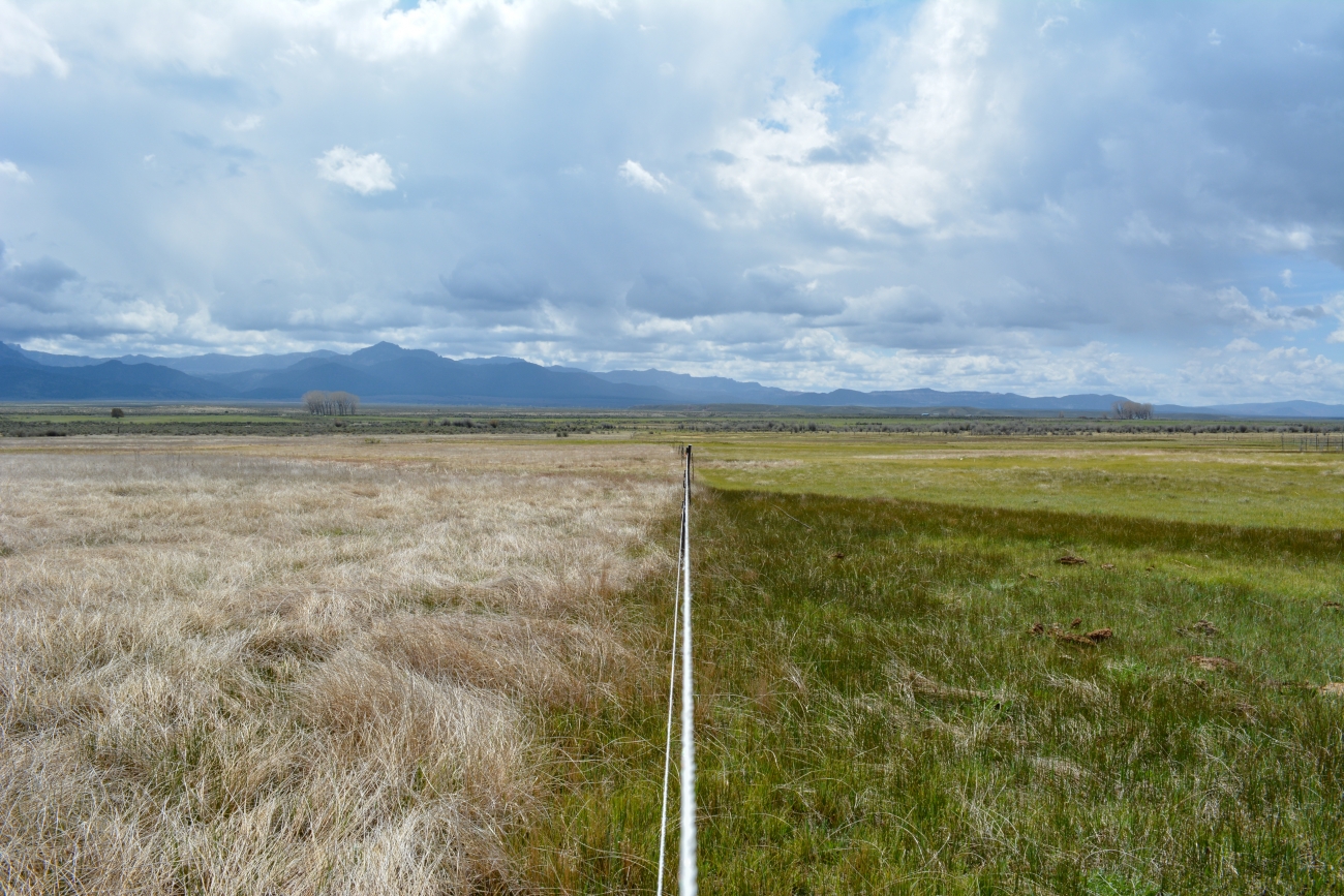
Clint Wirick/USFWS — illustrative comparison of grazed and ungrazed prairie, not a PREDICTS sampling site or model output. · USFWS Public Domain · Rights: Public domain

A detailed biodiversity map is not necessarily a reliable local prediction

A new global validation study finds that models of biodiversity pressure and response lose predictive skill when moved into unfamiliar ecological settings.

Evidence
Peer-reviewed
Geography
Global terrestrial evidence, 101 countries
System
Terrestrial biodiversity; land-use pressure; spatial modeling

WHAT THE EVIDENCE SAYS

Researchers used the PREDICTS biodiversity compilation, including observations from 101 countries, to evaluate alpha- and beta-diversity models against standard and cross-study validation. Models organized by biome, realm and taxonomic group improved interpolation compared with study-random-effect structures, but none transferred reliably to held-out ecological contexts. Human land-use signals remained visible, while site-level predictive accuracy was low.

WHY IT MATTERS / OUR READ

The familiar fine-grained biodiversity maps are frequently finer than the ecological evidence used to train them. Landscape-scale screening is still useful for prioritizing fieldwork; parcel or corridor decisions need local data and validation, not confidence borrowed from map pixel size. This is a direct challenge to treating high-resolution global biodiversity indicators as measured local condition.

CAVEATS / UNCERTAINTY

This evaluates particular model families and PREDICTS-derived historical records, not every available indicator. Poor local extrapolation does not invalidate broad direction-of-effect inferences. Stronger national data may improve predictions.

SOURCE

Nyström et al., Nature Ecology & Evolution (10 Nov 2026)
View original evidence ↗

Read the Wild Lands assessment

Deep Sargassum forests were hiding in plain sight near Lord Howe Island

Repeated remote-video surveys documented extensive algae forests at mesophotic depths, but the proposed climate refuge remains a hypothesis.

Evidence
Peer-reviewed
Geography
Lord Howe Island, New South Wales, Australia
System
Mesophotic rocky reefs; canopy-forming Sargassum

WHAT THE EVIDENCE SAYS

Marine-park video monitoring sampled 22 sites at 20–55 metres in 2022, finding dense Sargassum canopies at seven locations down to about 38 metres. Preserved specimens identified two Sargassum species. Comparisons with 2009, 2013 and 2017 footage showed major but spatially uneven increases; some sites lost cover between later surveys.

WHY IT MATTERS / OUR READ

A program built to survey fish revealed an overlooked habitat. Depth matters in coastal habitat inventories, and management baselines need repeat surveys across both vertical and horizontal habitat gradients. A newly mapped forest is evidence of ecological structure, not automatic proof that deeper water shields it from warming.

CAVEATS / UNCERTAINTY

Reef survey seasons and coverage differed across years; the mechanism behind increased cover was not experimentally isolated. The authors call a mesophotic refuge possible, not proven, and the 2024 marine heatwave merits follow-up.

SOURCE

Rees et al., Ecology (November 2026)
View original evidence ↗

Read the Wild Lands assessment

Seven years of warming grew the grass, but fire still shaped the species

A South African montane experiment separated warming effects on biomass from the longer-standing influence of fire on plant composition.

Evidence
Peer-reviewed
Geography
Drakensberg Mountains, South Africa
System
Montane grassland; warming and fire

WHAT THE EVIDENCE SAYS

A seven-year factorial field experiment nested warming chambers within an established fire experiment. Warming increased average air temperature by about 0.6°C and increased plant biomass, but fire history better explained differences among the 35 native plant species, and seven years of warming produced no significant species turnover. Ground microclimates varied across combined treatments.

WHY IT MATTERS / OUR READ

Biomass growth is not a synonym for plant-community resilience or restoration. Fire frequency and vegetation-mediated microclimates can influence the ecological outcome of warming; monitoring should record species composition and field conditions alongside productivity. Older evidence can still be newly important when it changes the management decision.

CAVEATS / UNCERTAINTY

Experiment-specific warming chambers and one South African montane setting do not establish a universal fire prescription. Null turnover over seven years does not mean longer-term composition is secure.

SOURCE

Eastment et al., Journal of Applied Ecology (7 Jun 2026)
View original evidence ↗

Read the Wild Lands assessment

Urban barriers and disease compounded an Australian frog decline

Two decades of growling grass frog monitoring reveal why a pathogen and habitat fragmentation cannot be planned for separately.

Evidence
Peer-reviewed
Geography
Greater Melbourne, Victoria, Australia
System
Urban wetlands; amphibian metapopulations; chytrid disease

WHAT THE EVIDENCE SAYS

Dynamic occupancy models of roughly two decades of monitoring showed a 38% decline in occupied sites for growling grass frogs. Higher modeled chytrid prevalence coincided with lower persistence, while urban barriers reduced recolonization. Simulations combining infection with urbanization generated greater-than-additive losses in about 78% of runs.

WHY IT MATTERS / OUR READ

Protecting a pond in isolation may leave its frog population without dispersal and recolonization routes. Disease pressure and the connectivity of wetland networks need to be addressed together. The model demonstrates an interacting risk system, not an individual disease treatment that has already been tested.

CAVEATS / UNCERTAINTY

Synergy was inferred from modeled counterfactuals rather than a randomized intervention, and its posterior support was not unequivocal. Disease prevalence and urban barriers may interact differently in other species and regions.

SOURCE

Heard et al., Ecological Applications (2026)
View original evidence ↗

Read the Wild Lands assessment

Global Radar

A wider field of view.

  1. Latvian rivers reveal why pharmaceutical mixtures need a screening rule

    A proposed cumulative index highlights a few high-impact compounds without simply adding every small risk quotient.

    Evidence
    Peer-reviewed
    Geography
    Surface waters near wastewater plants, Latvia
    System
    Freshwater micropollutants; wastewater

    WHAT THE EVIDENCE SAYS

    Researchers tested a proposed log-scaled cumulative mixture-risk index against seasonal upstream/downstream measurements of ten pharmaceuticals near Latvian wastewater treatment plants. A minority of compounds contributed disproportionately to the screening signal.

    WHY IT MATTERS / OUR READ

    Site comparisons may require mixture-sensitive triage before expensive compound-specific toxicity work.

    CAVEATS / UNCERTAINTY

    This is a screening index, not direct measurement of additive or synergistic organism-level effects; field-wide ecological validation remains necessary.

    SOURCE

    Frontiers in Water — pharmaceutical-mixture screening (accepted 9 Nov 2026)
    View original evidence ↗

    Read the Wild Lands assessment
  2. Lake Urmia's shallow depths were more accurately mapped by a tree model

    A satellite and field-comparison study shows promising bathymetry in one difficult hypersaline setting.

    Evidence
    Peer-reviewed
    Geography
    Lake Urmia, Iran
    System
    Hypersaline lake; satellite bathymetry

    WHAT THE EVIDENCE SAYS

    Using field depth observations and Landsat-8 predictors, authors compared four regressions. CatBoost attained held-out R² about 0.93 and RMSE near 9 cm under repeated evaluation, outperforming linear regression under the sampled lake conditions.

    WHY IT MATTERS / OUR READ

    Satellite tools can improve water-depth mapping in challenging shallow lakes when calibrated to local observations.

    CAVEATS / UNCERTAINTY

    Accuracy pertains to a specific lake scene and holdout design; transfer across salinity, season, sediment and depth requires independent validation.

    SOURCE

    Mojtahedi et al., Scientific Reports (9 Nov 2026)
    View original evidence ↗

    Read the Wild Lands assessment
  3. The Yangtze's water services did not all move together

    Basin-scale supply, demand, erosion control and nutrient indicators show diverging changes within one watershed.

    Evidence
    Peer-reviewed
    Geography
    Yangtze River Basin, China
    System
    Watershed ecosystem services; erosion and nitrogen

    WHAT THE EVIDENCE SAYS

    An InVEST-based 3-km-grid study covering 2000–2020 estimated increasing modeled water yield and soil conservation, declining modeled nitrogen export, and growing water demand. Spatial relationships varied across service and time.

    WHY IT MATTERS / OUR READ

    A rising basin-wide supply total can conceal districts where demand and ecological function are mismatched.

    CAVEATS / UNCERTAINTY

    Many service and demand variables are model outputs or proxies, not direct measurements of ecological improvement or local policy effects.

    SOURCE

    Ouyang et al., Scientific Reports (9 Nov 2026)
    View original evidence ↗

    Read the Wild Lands assessment
  4. China's environmental-monitoring pilot showed modest, conditional gains

    Better information may influence cleaner production, but the estimate is not a direct ecosystem-impact measurement.

    Evidence
    Peer-reviewed
    Geography
    268 Chinese prefectures, 2014–2023
    System
    City environmental governance; industrial monitoring

    WHAT THE EVIDENCE SAYS

    A difference-in-differences city panel linked smart-monitoring pilot designation to a modest short-run rise in an emissions-inclusive productivity indicator under province-clustered inference. A substitute productivity measure was not statistically significant; spatial spillover results were null.

    WHY IT MATTERS / OUR READ

    Monitoring capacity changes decisions through institutions, not merely through sensor deployment. Existing regulatory and digital capabilities moderated the association.

    CAVEATS / UNCERTAINTY

    A short observational post-treatment window and treatment-assignment structure constrain causal interpretation. Green productivity is not direct evidence of habitat or species recovery.

    SOURCE

    Li & Dai, Frontiers in Environmental Science (9 Nov 2026)
    View original evidence ↗

    Read the Wild Lands assessment
  5. An oat–pea mixture slowed forage yield decline at one alpine site

    Two-year field evidence links mixed sowing to yield stability and a different rhizosphere community.

    Evidence
    Peer-reviewed
    Geography
    Qinghai–Tibetan Plateau, China
    System
    Alpine forage pasture; rhizosphere microbiome

    WHAT THE EVIDENCE SAYS

    A two-year field experiment after five years of oat monocropping found the highest forage yield and smallest year-to-year decline in one oat–pea mixture. The mixture had an intermediate rhizosphere-community configuration, but microbial mechanisms remained correlative.

    WHY IT MATTERS / OUR READ

    Working-lands diversification merits locally replicated field trials, not a universal recommended sowing ratio.

    CAVEATS / UNCERTAINTY

    One site, two seasons and a specific cropping legacy; a microbial correlation cannot by itself explain a causal agronomic benefit.

    SOURCE

    Frontiers in Plant Science — oat–pea forage field trial (accepted 9 Nov 2026)
    View original evidence ↗

    Read the Wild Lands assessment
  6. Free-ranging Indian dogs read combined human cues more consistently

    An urban–rural animal-behavior experiment found approach temperament mattered more than choosing with a single gesture.

    Evidence
    Peer-reviewed
    Geography
    Free-ranging dogs, India
    System
    Human–dog behavioral ecology

    WHAT THE EVIDENCE SAYS

    Researchers approached 352 adult free-ranging dogs, with 309 completing familiarization. Correct bowl choice exceeded chance only when pointing and gaze aligned; dogs described as affiliative were more willing to engage, but demeanor did not predict accuracy among those choosing.

    WHY IT MATTERS / OUR READ

    Behavioral sampling can systematically exclude less approachable animals; willingness to participate is not interchangeable with cue comprehension.

    CAVEATS / UNCERTAINTY

    Combined-cue performance did not significantly differ from either single-cue condition, so evidence of a unique cue-integration mechanism is limited.

    SOURCE

    Nandi et al., Frontiers in Ecology and Evolution (accepted 9 Nov 2026)
    View original evidence ↗

    Read the Wild Lands assessment
  7. Cropland soil chemistry retained the signature of its parent rock

    Carbon and nutrient ratios shifted with cultivation, soil origin and their interaction.

    Evidence
    Peer-reviewed
    Geography
    Comparative land-use soil plots, China
    System
    Cultivated and forest soils; C:N:P:Fe stoichiometry

    WHAT THE EVIDENCE SAYS

    Researchers compared forest land with cultivated land uses across multiple soil parent materials, finding higher organic carbon and several C:N:P ratios in forest soils, as well as parent-material-specific iron oxide associations.

    WHY IT MATTERS / OUR READ

    Soil-carbon diagnoses should not treat crop conversion as the only driver; parent material can change what an apparently similar metric means.

    CAVEATS / UNCERTAINTY

    Observational chemical comparisons do not alone quantify long-term sequestration or prove which management practice caused the differences.

    SOURCE

    Frontiers in Soil Science — soil parent material study (accepted 9 Nov 2026)
    View original evidence ↗

    Read the Wild Lands assessment
  8. Shorebird outreach aligned with some improvements, not all

    Atlantic-coast field evaluations distinguish walk-around-flock campaigns from dog-leashing results.

    Evidence
    Peer-reviewed
    Geography
    U.S. Atlantic coast, five states
    System
    Beach nesting shorebirds; recreation pressure

    WHAT THE EVIDENCE SAYS

    Across the 2024 breeding season, nearly 1,000 shorebird point counts and more than 850 behavior observations linked walk-around-flock campaign sites to lower vigilance and evidence consistent with improved piping plover fledging. Dog-leashing campaign associations were mixed.

    WHY IT MATTERS / OUR READ

    Changing beach user behavior is worth measuring against bird responses, not merely distributing messages.

    CAVEATS / UNCERTAINTY

    Campaign associations are observational; staffing, beach selection and other covariates could contribute to differences. Publication was August 2026, newly screened in this reading cycle.

    SOURCE

    Saunders et al., Conservation Science and Practice (4 Aug 2026)
    View original evidence ↗

    Read the Wild Lands assessment
  9. Riparian restoration can be mapped as transitions, not just planting

    An Australian state-and-transition framework connects flow decisions, vegetation condition and measured targets.

    Evidence
    Peer-reviewed
    Geography
    Fragmented agricultural catchment, southeastern Australia
    System
    Riparian woodland; environmental flows

    WHAT THE EVIDENCE SAYS

    A riparian state-and-transition framework outlined how livestock grazing, flow alteration, weeds and clearing interact, then demonstrated site and catchment pathways for restoration in southeastern Australia.

    WHY IT MATTERS / OUR READ

    Managers can make targets explicit: what condition exists, what transition is achievable, and what water or site action might move the system.

    CAVEATS / UNCERTAINTY

    A demonstrated decision framework is not a controlled trial showing ecological recovery; it needs local refinement and measured outcomes.

    SOURCE

    Good & Jones, Ecological Applications (24 May 2026)
    View original evidence ↗

    Read the Wild Lands assessment
  10. Ghana's crocodile clans described conservation through customary duty

    Interviews documented locally legitimate rules for crocodiles and ponds; ecological effectiveness remains unmeasured.

    Evidence
    Peer-reviewed
    Geography
    Paga and Nyibivian crocodile communities, Ghana
    System
    Crocodile wetlands; Indigenous customary governance

    WHAT THE EVIDENCE SAYS

    A qualitative multisite study interviewed 37 participants and recorded customary responsibilities involving crocodile protection, pond care, pollution prevention, community education and sanctions, with differences between the two communities.

    WHY IT MATTERS / OUR READ

    Culturally embedded governance is part of a conservation landscape and should be understood on its own terms rather than forced into an external program model.

    CAVEATS / UNCERTAINTY

    Participants were purposefully recruited and ecological outcomes were not measured; the study cannot establish a population increase or superior wetland condition.

    SOURCE

    Marifah et al., Frontiers in Ecology and Evolution (accepted 5 Nov 2026)
    View original evidence ↗

    Read the Wild Lands assessment

Landscape / City Watch

Cities are ecological systems.

Urban anoles did not follow the same body-size pattern as forest anoles

A meta-analysis found native and invasive lizards' sizes responded differently to coexistence across habitats.

Evidence
Peer-reviewed
Geography
Southeastern United States and Caribbean anole records
System
Urban and forest reptile assemblages

WHAT THE EVIDENCE SAYS

A meta-regression of 126 sex-specific samples for green and brown anoles found different associations of body size with coexistence history in forest versus urban contexts. In forests invasive brown anoles tended larger and native green anoles smaller with coexistence; both tended smaller in urban contexts.

WHY IT MATTERS / OUR READ

Cities do not create one universal morphological response to invasion. Habitat context must remain inside evolutionary and ecological interpretation.

CAVEATS / UNCERTAINTY

The analysis draws on heterogeneous published samples and inferred establishment timelines; patterns do not demonstrate individual animals adapting during the study or prove a single cause.

SOURCE

Medina & Bleicher, Frontiers in Ecology and Evolution (9 Nov 2026)
View original evidence ↗

Read the Wild Lands assessment

November 10, 2026 · Issue 056

Today’s lead is a caution about maps that look more precise than their evidence: a new global study finds poor local predictive transfer from biodiversity models. Field evidence supplies the corrective texture. Lord Howe Island’s deep Sargassum stands emerged through repeated marine monitoring; South African grasslands responded to warming in biomass without matching species turnover; and Australian frogs illustrate how disease and urban fragmentation reinforce population losses. Across freshwater, agriculture and governance, measurements only matter when they change the right decision.

Land Manager Watch

Evidence for decisions on land, water and habitat

Peer-reviewed · Spain, Morocco and Italy; four Mediterranean living labs

Forest stakeholders did not choose the modeled drought-resilience leaders

Four Mediterranean living labs show why explicit resilience metrics belong alongside participatory management priorities.

Management read

A stewardship plan should show decision-makers the resilience trade-off alongside locally valued outputs. In drought- and fire-prone landscapes, document which alternative optimizes which outcome, then decide explicitly rather than equating agreement with long-term resilience. This is a decision-design lesson, not a case for overriding community priorities.

Caveat / uncertainty: Resilience rankings depend on the CAFE model and its assumptions; choosing other outcomes is not necessarily an error. Four geographically specific living labs cannot justify a universal prescription.

Read the full evidence, caveats & Land Manager analysis →

Editorial thread to watch

Three distinctions bind this issue. First, scale and validation: a model’s spatial resolution is not its predictive skill, while satellite lake-depth estimates and Yangtze service maps need local checks. Second, structure and process: radar forest disturbance is not early regrowth, an algal forest at depth is not yet a confirmed climate refuge, and land-use changes soil chemistry through parent material. Third, implementation is social and ecological: Ghanaian crocodile customs describe responsibility but not measured population outcomes; shorebird outreach shows mixed field responses; and Mediterranean stakeholders need explicit long-horizon resilience metrics, not a lecture about making the 'correct' choice.