Skip to content
Ecological Intelligence

Ecological evidence.
Independent perspective.
Explore Wild Lands ↗

Morning Brief Global edition

October 17, 2026 · Issue 032

Old-growth canopy can remain on a map while invasive barred owls share the same habitat needed by native spotted owls. Elsewhere, protected prairie parcels hold disproportionate modeled bird habitat, and tropical forest sites retain frugivore species while their actual fruit visits change. Across forests, easements, rivers and cities, today's evidence asks a sharper question: what ecological function survives after we count the acres, structures or projects we have protected? A new Pacific measurement campaign and mangrove-policy proposals underscore the same divide between setting up a system and documenting results.

Land Manager Watch

Evidence for decisions on land, water and habitat

Peer-reviewed · Rio Grande riparian corridor, Texas, United States; 167 surveyed sites

Giant reed removal should be judged by the riparian habitat it leaves

Rio Grande occupancy models find bird responses to invasive reed cover are mixed, not universal.

Management read

Set the objective as functional riparian habitat, not simply acres of reed cleared. Survey native woody and herbaceous cover, target bird guilds, erosion and follow-up regeneration before deciding where to control, what to replant and how to judge outcomes.

Caveat / uncertainty: Occupancy associations do not establish reed as the cause of each response, and this was not a field experiment comparing control methods. It cannot prove that clearing alone will recover birds or that doing nothing is harmless.

Read the full evidence, caveats & Land Manager analysis →

Editorial thread to watch

Look beyond the convenient indicator. Barred-owl telemetry makes structure different from viable population habitat; French Guiana frugivore cameras separate richness from interaction frequency; conservation easements differ by the species they serve. Forest retention introduces edge consequences, caribou habitat can combine forage and risk, and a river barrier's removal produces responses over years rather than on demolition day. The counter-signal from Indian urban arthropods resists a universal disturbance rule. On the Rio Grande, giant-reed management asks what habitat replaces the reed and which animal guilds actually respond. These are decisions under evidence, not tidy before-and-after stories.

Priority Reads

The evidence that deserves a closer look.

Barred owls used the old forests that spotted owls also need
USFWS. Illustrative Nowitna, Alaska, conifer-river forest photograph; not a California owl telemetry site. · Public domain — U.S. Fish & Wildlife Service media asset. · Rights: Public domain

Barred owls used the old forests that spotted owls also need

Telemetry in northern California finds an invasive competitor selecting mature forest structure rather than avoiding it.

Evidence
Peer-reviewed
Geography
Northwestern California, United States; barred owl telemetry territories
System
Old conifer forests; spotted-owl habitat; invasive predator competition

WHAT THE EVIDENCE SAYS

Researchers tracked 56 barred owls in northwestern California and found habitat selection associated with older, taller forest features also valued by northern spotted owls. Individual barred-owl territories in this study were estimated to be approximately 28 times the home-range area used by barred owls in their native eastern range. This indicates substantial spatial variation and habitat overlap, not a direct count of spotted owls displaced.

WHY IT MATTERS / OUR READ

Protecting mature forest remains important, but a forest can be structurally suitable and still fail to sustain its intended species when biological interactions change. Monitoring should link forest condition to occupancy, competition and survival, rather than equating habitat acres with recovery.

CAVEATS / UNCERTAINTY

Observational telemetry cannot by itself measure spotted-owl population effects or establish that a particular management intervention would succeed. Home-range comparisons involve different landscapes and populations; do not transfer the 28-fold ratio elsewhere.

SOURCE

USDA Forest Service indexed peer-reviewed Biological Conservation study
View original evidence ↗
Read the Wild Lands assessment

Prairie conservation lands held disproportionate modeled bird habitat

A regional analysis finds different conservation easements benefit different breeding-bird assemblages.

Evidence
Peer-reviewed
Geography
Prairie Pothole Joint Venture region, central North America
System
Prairie wetlands and grasslands; easements; breeding-bird distributions

WHAT THE EVIDENCE SAYS

Researchers modeled distributions of 77 bird species across the Prairie Pothole Joint Venture and related them to U.S. Fish and Wildlife Service fee-title lands and grassland or wetland easements. These protected holdings accounted for less than five percent of the mapped land but represented a disproportionate share of predicted bird occurrences; patterns differed between waterfowl and other breeding birds.

WHY IT MATTERS / OUR READ

A conservation acre is not interchangeable with another acre. Planners should choose tools and locations according to the species and ecological processes a parcel supports, then monitor real bird outcomes and the pressures surrounding it.

CAVEATS / UNCERTAINTY

The analysis uses modeled occurrence rather than experimental evidence that acquisition caused bird gains; species predictions and landscape composition influence comparisons. The journal record is an accepted peer-reviewed article awaiting final formatting.

SOURCE

Frontiers in Ecology and Evolution · prairie conservation distribution analysis
View original evidence ↗

Read the Wild Lands assessment

A tropical forest retained fruit-eater species while their visits changed

French Guiana camera traps expose a functional difference hidden by species-richness totals.

A tropical forest retained fruit-eater species while their visits changed
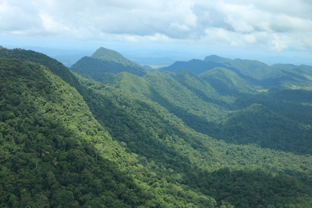
Levi Novey/USFWS. Illustrative Honduras and Belize forest landscape; not the French Guiana study site. · Public domain — U.S. Fish & Wildlife Service media asset. · Rights: Public domain
Evidence
Peer-reviewed
Geography
Three forest sites, French Guiana, South America
System
Tropical fruiting trees; frugivore visitation; forest disturbance

WHAT THE EVIDENCE SAYS

Sixty camera traps documented visitors to two Virola tree species across mature protected, formerly exploited and currently disturbed French Guiana forest sites. Canopy and understory visitor richness remained broadly similar, but ground-dwelling frugivore visits were substantially fewer at the currently disturbed site, while arboreal visitation and community composition shifted.

WHY IT MATTERS / OUR READ

A biodiversity inventory can stay impressive while the frequency and identity of potential ecological interactions change. For restoration and timber-land decisions, animal visitation, guild structure and actual seed dispersal warrant attention alongside species lists.

CAVEATS / UNCERTAINTY

Three nonrandomly selected sites and visitation observations cannot isolate logging, hunting and road effects or directly demonstrate reductions in viable seed dispersal. Findings are site- and fruit-tree-specific.

SOURCE

Ecology and Evolution · French Guiana frugivore camera-trap field study
View original evidence ↗

Read the Wild Lands assessment

Retention patches protect some habitat while creating new forest edges

A landscape model quantifies why the geometry of retained forest matters as well as the retained percentage.

Evidence
Peer-reviewed
Geography
Modeled managed forest landscapes, North America
System
Forest harvesting; aggregate retention; edge effects

WHAT THE EVIDENCE SAYS

Researchers used approximately 105,000 simulated managed-landscape configurations to examine aggregated retention under fixed harvested-area assumptions. The simulations found that placing 20 percent of harvested stands into retention could increase the area influenced by forest edges by roughly four to 30 percent per harvested area, depending on the chosen edge-distance definition.

WHY IT MATTERS / OUR READ

Keeping live forest inside a working landscape has value, but a stand-level retention percentage is not a landscape design. Patch shapes, connected cores and exposure of neighboring stands can materially change which ecological conditions remain.

CAVEATS / UNCERTAINTY

These are geometric model outcomes, not measured wildlife, carbon or forest-growth responses. Edge-effect distances and harvesting assumptions determine the estimates; no universal prescription follows from this calculation.

SOURCE

Landscape Ecology · forest retention and edge-modeling study
View original evidence ↗

Read the Wild Lands assessment

Global Radar

A wider field of view.

  1. Young clearcuts attracted caribou forage and potentially greater risk

    Paired vegetation and predator observations distinguish nutritional opportunity from safety.

    Evidence
    Peer-reviewed
    Geography
    West-central British Columbia, Canada
    System
    Boreal forest; caribou foraging; forestry and predator exposure

    WHAT THE EVIDENCE SAYS

    A study using 71 caribou GPS datasets, 56 paired vegetation plots and 149 predator-camera stations found relatively recent harvested stands could provide forage resources selected by caribou while also coinciding with greater modeled wolf exposure. Habitat selection and predator exposure did not map onto a single good-versus-bad treatment label.

    WHY IT MATTERS / OUR READ

    Management must compare what animals gain from a site with the encounter risks they inherit there. Reforestation, harvest configuration and predator ecology are linked decisions rather than independent habitat metrics.

    CAVEATS / UNCERTAINTY

    Predator exposure was inferred from monitored patterns, not measured mortality or population growth; telemetry selection does not demonstrate net fitness benefits. This study does not establish a universal clearcut age threshold.

    SOURCE

    Landscape Ecology · caribou forest-selection field analysis
    View original evidence ↗

    Read the Wild Lands assessment
  2. Maps of wildlife movement and climate refugia did not always agree

    Comparing 103 connectivity maps reveals priorities that depend heavily on model purpose.

    Evidence
    Peer-reviewed
    Geography
    Far western North America; 103 conservation connectivity maps
    System
    Habitat connectivity; climate adaptation; spatial decision-making

    WHAT THE EVIDENCE SAYS

    A comparison of 103 connectivity and climate-adaptation maps in far western North America documented divergent priorities among approaches that represented existing ecological movement patterns versus longer-term climate-related connectivity. Areas of convergence were fewer and more selective than a single generalized corridor map might suggest.

    WHY IT MATTERS / OUR READ

    GIS synthesis should show where layers agree, where they conflict and which biological decision each serves. A route useful for present-day movement may not be the same landscape investment needed under future climate change.

    CAVEATS / UNCERTAINTY

    A comparison of modeled spatial products is not a direct test of animal movement or realized adaptation; input scales and assumptions influence apparent agreement.

    SOURCE

    Landscape Ecology · western North America connectivity-map comparison
    View original evidence ↗

    Read the Wild Lands assessment
  3. One Mexican river held fish functions not captured by species totals

    Functional traits revealed uneven distributions of ecological roles across a river network.

    Evidence
    Peer-reviewed
    Geography
    Amacuzac River, Mexico
    System
    Freshwater fishes; river functional diversity

    WHAT THE EVIDENCE SAYS

    An Amacuzac River field survey recorded 17 fish species and analyzed 19 ecological functional traits across eight functional groups. Functional diversity varied between sampling reaches, with a downstream reach showing a comparatively high complement of functions; several functional roles were represented by a single species.

    WHY IT MATTERS / OUR READ

    If conservation planning counts only species, it can miss whether particular feeding, habitat or movement roles remain in a river. Maintaining functional redundancy may make restoration outcomes more resilient.

    CAVEATS / UNCERTAINTY

    Site comparisons are observational and time-limited; high functional richness is not direct evidence of good water quality or restored ecosystem condition. Trait categories and sampling effort influence results.

    SOURCE

    Neotropical Ichthyology · Amacuzac river fish trait study
    View original evidence ↗

    Read the Wild Lands assessment
  4. Senegal's protected mangrove still faced changes beyond its boundary

    A Joal-Fadiouth assessment connects a small mapped area loss to persistent local pressures.

    Evidence
    Peer-reviewed
    Geography
    Joal-Fadiouth Marine Protected Area, Senegal
    System
    Mangrove extent; artisanal shellfish use; coastal livelihoods

    WHAT THE EVIDENCE SAYS

    A remote-sensing and field-based study of the Joal-Fadiouth protected coastal system estimated mangrove extent at about 10.259 square kilometers in 1974 and 10.122 in 2024, a net decline of roughly 0.137 square kilometers. Local interviews also identified continuing pressures associated with salinity, resource use, infrastructure and pollution.

    WHY IT MATTERS / OUR READ

    A designation is an institutional boundary; estuarine hydrology, infrastructure and livelihoods determine much of what happens inside it. Restoration monitoring should pair canopy area with water and use pressures.

    CAVEATS / UNCERTAINTY

    Small area differences over five decades are sensitive to image classification and baseline comparability. Interviews are descriptive; they do not establish protected-area effectiveness or causal links between a single pressure and net area change.

    SOURCE

    International Journal of Biological and Chemical Sciences · Senegal mangrove assessment
    View original evidence ↗

    Read the Wild Lands assessment
  5. Prescribed-fire season altered soil-carbon responses in a California forest

    Fall and spring burns differed in near-surface carbon dynamics rather than delivering an interchangeable treatment.

    Evidence
    Peer-reviewed
    Geography
    Young mixed-conifer forest, California, United States
    System
    Prescribed fire; forest soils; carbon cycling

    WHAT THE EVIDENCE SAYS

    A peer-reviewed U.S. Forest Service-linked field study compared spring and fall prescribed fires in a young mixed-conifer forest. Surface soil-carbon fractions and microbial activity responded differently: fall burns showed sharper immediate reductions in particulate organic carbon, while spring treatment maintained or increased some measures over the following two years.

    WHY IT MATTERS / OUR READ

    Burn timing is an ecological treatment choice as well as an operational window. Fuel moisture, burn severity and management objectives must accompany subsequent soil monitoring before managers compare prescribed-fire results.

    CAVEATS / UNCERTAINTY

    This is one forest context and limited post-burn period; treatment intensity and fuel consumption can partly explain observed differences. Soil carbon alone cannot determine the best safe fire window.

    SOURCE

    Forest Ecology and Management · California prescribed-fire season study
    View original evidence ↗

    Read the Wild Lands assessment
  6. A salmon supply chain made climate responsibility an institutional problem

    Interviews with a seafood company illuminate why Scope 3 action depends on the rules surrounding suppliers.

    Evidence
    Peer-reviewed
    Geography
    United Kingdom, Norway and Scotland seafood supply-chain relationships
    System
    Aquaculture; corporate environmental governance; value chains

    WHAT THE EVIDENCE SAYS

    A qualitative international-business analysis published October 16 examines a multinational salmon supply chain in which a parent company and its British subsidiary coordinated suppliers operating under differing national institutions. The paper traces how reporting expectations and local practices shape work on indirect supply-chain emissions.

    WHY IT MATTERS / OUR READ

    Environmental ambition becomes measurable only when buyers, farms, reporting methods and verification systems can act together. A supplier code or climate target is not, by itself, a measured ecological outcome.

    CAVEATS / UNCERTAINTY

    Interview and documentary evidence describe governance and coordination; they do not independently verify actual emissions reductions, fish welfare improvements or additional conservation outcomes.

    SOURCE

    Management International Review · salmon supply-chain institutional study
    View original evidence ↗

    Read the Wild Lands assessment
  7. Pacific research teams began a transect from equator to Southern Ocean

    A new voyage connects full-depth ocean measurements with regional forecasting needs.

    Evidence
    Institutional / NGO report
    Geography
    Central Pacific transect toward Antarctic waters
    System
    Ocean observation; climate processes; research cooperation

    WHAT THE EVIDENCE SAYS

    On October 16 Australia's CSIRO described an RV Investigator voyage already under way with 70 researchers from 15 institutions along the 170°W Pacific transect from equatorial waters toward the Antarctic ice edge. The mission combines physical, chemical and biological measurements, regional research partnerships and modeling objectives; the voyage is not evidence that its eventual analyses or management outcomes are complete.

    WHY IT MATTERS / OUR READ

    Sustained ocean measurement is infrastructure for later climate and ecological decisions. The value of this campaign will depend on quality-controlled data, accessible products and whether regional managers can actually use them.

    CAVEATS / UNCERTAINTY

    This is an official description of research activity, not a peer-reviewed result, an observed climate trend or proof that models or management decisions have improved.

    SOURCE

    CSIRO · October 16, 2026 ocean-voyage announcement
    View original evidence ↗

    Read the Wild Lands assessment
  8. New mangrove briefs seek coherence across global environmental conventions

    The Global Mangrove Alliance urges countries to align the three Rio Conventions and the Ramsar Convention on monitoring, finance and action.

    Evidence
    Institutional / NGO report
    Geography
    Global mangrove policy and multilateral conservation conventions
    System
    Mangrove governance; climate and biodiversity conventions

    WHAT THE EVIDENCE SAYS

    On October 16 the Global Mangrove Alliance released two policy briefs ahead of CBD COP17. They propose greater alignment among the three Rio Conventions (biodiversity, climate change and desertification) and the Ramsar Convention on Wetlands, including clearer national commitments, funding and monitoring for mangrove conservation programs. These are recommendations, not implemented treaty changes.

    WHY IT MATTERS / OUR READ

    For a coastal project, one ecosystem may answer to several governmental and funding frameworks. Real outcomes require accountable implementation, specific ecological measures and funds reaching durable field management, not merely aligned policy language.

    CAVEATS / UNCERTAINTY

    The publications advocate policy approaches; they are not independent evidence of implementation, legally binding treaty changes, new finance disbursed or mangrove recovery.

    SOURCE

    Wetlands International / Global Mangrove Alliance · October 16, 2026 policy brief announcement
    View original evidence ↗

    Read the Wild Lands assessment
  9. After a New Jersey dam came down, water conditions changed over years

    A multiyear river study documents a cooler, better-oxygenated relative downstream signal.

    Evidence
    Peer-reviewed
    Geography
    Paulins Kill, New Jersey, United States; former Columbia Dam
    System
    River restoration; dam removal; thermal regime; aquatic communities

    WHAT THE EVIDENCE SAYS

    Researchers compared Paulins Kill conditions across two pre-removal years, two removal years and five years afterward at sites upstream and downstream of the former Columbia Dam. Post-removal downstream relative water temperature decreased by an estimated 0.29 degrees Celsius, while relative dissolved oxygen increased about 0.14 mg/L; aquatic indicators and fish passage also changed over time.

    WHY IT MATTERS / OUR READ

    The ecological case for barrier removal is not one number recorded on demolition day. Baseline and multi-year follow-up can reveal thermal, oxygen and community responses, with benefits and temporary disruptions occurring on different timetables.

    CAVEATS / UNCERTAINTY

    Single-river, nonrandomized before-after evidence cannot isolate every coincident driver; detected fish presence is not a measured recovery in population size. Effects depend on dam geometry and river context.

    SOURCE

    Frontiers in Ecology and Evolution · Columbia Dam removal monitoring study
    View original evidence ↗

    Read the Wild Lands assessment
  10. More shrubs increased some landscape diversity but reduced grassland richness

    Northern Iberian plots show a hump-shaped biodiversity response to woody encroachment.

    Evidence
    Peer-reviewed
    Geography
    Four northern Iberian study landscapes, Spain and Portugal
    System
    Grassland succession; shrub encroachment; biodiversity

    WHAT THE EVIDENCE SAYS

    Across four northern Iberian landscapes, researchers compared vegetation and biodiversity measures along woody encroachment gradients. Some functional and phylogenetic diversity rose as shrubs entered, while taxonomic diversity peaked around lower to intermediate shrub levels before dropping under denser woody cover.

    WHY IT MATTERS / OUR READ

    Preventing every shrub or allowing complete woody takeover are both crude prescriptions. Management for open-habitat specialists needs explicit targets and mosaics, not a blanket equation between more biomass and more biodiversity.

    CAVEATS / UNCERTAINTY

    Observational gradient comparisons do not show the effect of a prescribed intervention, and responses differ by assemblage, site history and the diversity metric chosen.

    SOURCE

    Landscape Ecology · Iberian woody-encroachment biodiversity study
    View original evidence ↗

    Read the Wild Lands assessment

Landscape / City Watch

Cities are ecological systems.

A greener urban-growth scenario still left old habitat barriers intact

Yangtze River Delta connectivity modeling distinguishes prevented future damage from repairing existing fragmentation.

Evidence
Peer-reviewed
Geography
Yangtze River Delta urban region, China
System
Urban development; ecological networks; landscape connectivity

WHAT THE EVIDENCE SAYS

A spatial scenario study of the Yangtze River Delta compared future urbanization and ecological-protection pathways through 2035. It projected major built-up expansion under a development-oriented scenario and relatively small net ecological-space gains under protection assumptions; important inherited connectivity bottlenecks persisted even in the more favorable scenario.

WHY IT MATTERS / OUR READ

A planning rule that slows habitat conversion does not necessarily restore connections already severed by infrastructure. Effective blue-green network plans should distinguish avoided loss, restored passage and feasible long-term management.

CAVEATS / UNCERTAINTY

These are model scenarios, not measured 2035 outcomes or validated animal movements. Land-cover definitions, scenario inputs and spatial resolution constrain quantitative forecasts; accepted journal version awaits final formatting.

SOURCE

Frontiers in Ecology and Evolution · Yangtze Delta urban-connectivity scenario study
View original evidence ↗

Read the Wild Lands assessment

October 17, 2026 · Issue 032

Old-growth canopy can remain on a map while invasive barred owls share the same habitat needed by native spotted owls. Elsewhere, protected prairie parcels hold disproportionate modeled bird habitat, and tropical forest sites retain frugivore species while their actual fruit visits change. Across forests, easements, rivers and cities, today's evidence asks a sharper question: what ecological function survives after we count the acres, structures or projects we have protected? A new Pacific measurement campaign and mangrove-policy proposals underscore the same divide between setting up a system and documenting results.

Land Manager Watch

Evidence for decisions on land, water and habitat

Peer-reviewed · Rio Grande riparian corridor, Texas, United States; 167 surveyed sites

Giant reed removal should be judged by the riparian habitat it leaves

Rio Grande occupancy models find bird responses to invasive reed cover are mixed, not universal.

Management read

Set the objective as functional riparian habitat, not simply acres of reed cleared. Survey native woody and herbaceous cover, target bird guilds, erosion and follow-up regeneration before deciding where to control, what to replant and how to judge outcomes.

Caveat / uncertainty: Occupancy associations do not establish reed as the cause of each response, and this was not a field experiment comparing control methods. It cannot prove that clearing alone will recover birds or that doing nothing is harmless.

Read the full evidence, caveats & Land Manager analysis →

Editorial thread to watch

Look beyond the convenient indicator. Barred-owl telemetry makes structure different from viable population habitat; French Guiana frugivore cameras separate richness from interaction frequency; conservation easements differ by the species they serve. Forest retention introduces edge consequences, caribou habitat can combine forage and risk, and a river barrier's removal produces responses over years rather than on demolition day. The counter-signal from Indian urban arthropods resists a universal disturbance rule. On the Rio Grande, giant-reed management asks what habitat replaces the reed and which animal guilds actually respond. These are decisions under evidence, not tidy before-and-after stories.