Skip to content
Ecological Intelligence

Ecological evidence.
Independent perspective.
Explore Wild Lands ↗

Morning Brief Global edition

October 21, 2026 · Issue 036

An artificial stream may shelter real river life without behaving like a natural watershed. Today's Swedish field survey shows why the word 'ditch' is a poor ecological diagnosis. In southern China, mixed plantations earned higher aggregate multifunctionality scores while leaving important regeneration and water indicators comparatively weak. Pilot whales around Madeira spent time near an island and crossed the Atlantic; a Yellow River Delta synthesis asks restoration planners to think across sediment, salinity and estuary boundaries. The recurring challenge is not just what we call a landscape, but what it does.

Land Manager Watch

Evidence for decisions on land, water and habitat

Peer-reviewed · Nebraska and Great Lakes long-term trials, United States

Soil-carbon results can reverse when you sample below the surface

Midwest long-term experiments argue for depth-aware stewardship and monitoring.

Management read

For working lands, choose a clear baseline and repeatable sampling depth before treating shallow carbon change as success. Compare profiles, record vegetation and residue histories, and evaluate multiple carbon indicators.

Caveat / uncertainty: Only three trials and specific management histories; results cannot establish that switchgrass generally depletes carbon or that any one fraction certifies credits.

Read the full evidence, caveats & Land Manager analysis →

Editorial thread to watch

This issue follows a distinction between labels, models and measured ecological function. Artificial waterways can hold macroinvertebrate communities without becoming hydrologically equivalent to natural streams. A forest's high multifunctionality average need not imply that every service is healthy; a whale's seasonal residency is not its full range. In Jordan, potential soil-carbon gains remain simulations, while a Queensland monitoring study offers a measured counter-signal to broad PFAS ubiquity claims. The land-manager evidence completes the loop: soil carbon results change when sampling depth and fractions change. Choosing the correct measurement is often the first management decision.

Priority Reads

The evidence that deserves a closer look.

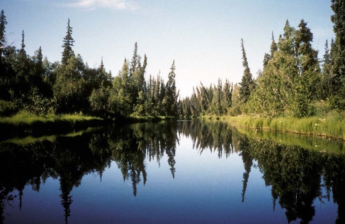
A drainage ditch can hold river life without becoming a natural stream
USFWS — illustrative Nowitna River, Alaska (NOT the Swedish study site) · Public domain (USFWS) · Rights: Public domain

A drainage ditch can hold river life without becoming a natural stream

Swedish boreal channels approached natural-stream communities—but soils and chemistry still mattered.

Evidence
Peer-reviewed
Geography
Krycklan catchment, northern Sweden
System
Boreal forest headwaters

WHAT THE EVIDENCE SAYS

Sampling 32 reaches across natural streams, modified waterways and ditches showed higher macroinvertebrate taxa richness in natural streams, while overall diversity and abundance were similar across waterway classes. Till ditches and modified channels often resembled natural streams; peat ditches had different acidity and substrates. Catchment size and pH helped explain richness.

WHY IT MATTERS / OUR READ

The word artificial is a poor ecological diagnosis. Before infilling or reshaping long-established forest drainage, examine organisms already using it, the local hydrology and soil, and potential wetland, peat-carbon and flood consequences.

CAVEATS / UNCERTAINTY

One Swedish catchment and benthic invertebrate metrics do not prove hydrologic equivalence, fish passage, carbon balance or restoration outcomes.

SOURCE

Ambio — Zivec et al. (2026)
View original evidence ↗

Read the Wild Lands assessment

Mixed forests scored highest—and still left important functions behind

A Chinese forest comparison shows how an impressive multifunctionality score conceals service imbalances.

Evidence
Peer-reviewed
Geography
Four subtropical regions of southern China
System
Plantation and secondary forest

WHAT THE EVIDENCE SAYS

Across 36 plots in 32–39-year-old stands, mixed Cunninghamia-broadleaf plantations had the highest mean ecosystem multifunctionality (0.559, against 0.403 secondary and 0.383 pure plantations). They also contained the most strongly imbalanced service pairs; regeneration remained relatively weak and water retention was stronger in secondary forests.

WHY IT MATTERS / OUR READ

An average restoration score is not a balanced ecological service bundle. Track regeneration, hydrology, diversity, soil and carbon separately to judge whether site-specific management goals are actually advancing.

CAVEATS / UNCERTAINTY

Observational, middle-aged-stand comparison; it cannot isolate causal benefits of mixing species or demonstrate long-term resilience.

SOURCE

Frontiers in Plant Science — Wu et al. (2026)
View original evidence ↗

Read the Wild Lands assessment

Madeira's pilot whales were residents and travelers at the same time

Ocean structure helped distinguish seasonal aggregation near an island from Atlantic travel.

Evidence
Peer-reviewed
Geography
Madeira and Northeast Atlantic
System
Pelagic marine mammal migration

WHAT THE EVIDENCE SAYS

Sixteen tagged short-finned pilot whales tracked between 2018 and 2024 cumulatively crossed a region of 1.17 million square kilometres, yet stayed near Madeira for a mean consecutive 53 days. State modelling linked area-restricted searching to shallow mixed layers and travel to deeper mixing; photo-identification confirmed mixed island-fidelity classes.

WHY IT MATTERS / OUR READ

Island waters can be valuable seasonal habitat without enclosing a population's range. Marine management should account for time-varying aggregation, dynamic ocean layers and movements across fixed jurisdictional boundaries.

CAVEATS / UNCERTAINTY

Only sixteen tags, uneven observation periods and environmental associations; not proof of oceanographic causation or protection effectiveness.

SOURCE

Movement Ecology — pilot whale telemetry study (2026)
View original evidence ↗

Read the Wild Lands assessment

Delta restoration fails when river, coast and wetland are managed separately

A Yellow River Delta review links sediment, salinity, invasions and institutions.

Evidence
Peer-reviewed
Geography
Yellow River Delta, China
System
Estuarine wetlands and river-coast interface

WHAT THE EVIDENCE SAYS

A multidisciplinary review describes degradation driven by altered river-water and sediment supply, saltwater intrusion, invasions and intensive human activity. It proposes integration across hydrology, salinity, topography, biological processes, river-to-sea space and competing restoration objectives, with adaptive-management and digital-twin options.

WHY IT MATTERS / OUR READ

An invasive-control project, tidal-wetland planting or hydrologic fix may underperform when adjacent sediment or salinity dynamics are ignored. Design monitoring for exchange between the river, delta and nearshore sea.

CAVEATS / UNCERTAINTY

This is a review and proposed framework, not an experimental evaluation of a specific restoration package or digital twin.

SOURCE

Frontiers in Marine Science — Peng et al. (2026)
View original evidence ↗

Read the Wild Lands assessment

Global Radar

A wider field of view.

  1. Crop rotation changed pathogen signals more clearly than soil diversity

    A tropical Brazilian experiment reports mixed, underpowered microbial outcomes.

    Evidence
    Peer-reviewed
    Geography
    Tropical field site, Brazil
    System
    Cropland microbiome and pathogens

    WHAT THE EVIDENCE SAYS

    In a four-season maize–soybean experiment, rotation did not detectably improve bacterial diversity in early seasons. In the fourth season rotation history coincided with lower fum1 abundance in bulk soil, while crop-residue and disease responses pointed differently.

    WHY IT MATTERS / OUR READ

    Microbial-diversity scores, pathogen DNA in soil and real crop disease can tell different stories; sample more than one biological compartment.

    CAVEATS / UNCERTAINTY

    Single site and four plots per treatment, with low power for early-season comparisons. No broadly generalizable causal crop-rotation prescription.

    SOURCE

    World Journal of Microbiology and Biotechnology — Almeida et al. (2026)
    View original evidence ↗

    Read the Wild Lands assessment
  2. Rwanda's worst erosion hotspots combined bare ground and steep slopes

    Catchment modelling can focus field verification and conservation investment.

    Evidence
    Peer-reviewed
    Geography
    Akanyaru catchment, Rwanda
    System
    Agricultural watershed erosion

    WHAT THE EVIDENCE SAYS

    GIS/RUSLE modelling across 3,402 square kilometres estimated annual soil loss from near zero to 51.4 tonnes per hectare, with higher modelled losses on steep degraded and intensively farmed slopes.

    WHY IT MATTERS / OUR READ

    Spatial risk surfaces can prioritize consultations and erosion-control reconnaissance rather than assign uniform prescriptions to an entire catchment.

    CAVEATS / UNCERTAINTY

    RUSLE produces modeled hillslope detachment, not field-measured sediment delivered to wetlands; conservative support-practice assumptions affect estimates.

    SOURCE

    Discover Soil — Ntirenganya et al. (2026)
    View original evidence ↗

    Read the Wild Lands assessment
  3. Cassava pests and crop traits varied across Sierra Leone's regions

    Farm visits expose disease, planting-material and agroecological heterogeneity.

    Evidence
    Peer-reviewed
    Geography
    Sierra Leone, five regions
    System
    Smallholder crop disease ecology

    WHAT THE EVIDENCE SAYS

    A January 2022 survey measured morphology, pests and cassava mosaic symptoms on 276 farms, sampling 30 plants per farm. Whitefly and grasshopper counts varied geographically, and disease-severity patterns differed by farm size.

    WHY IT MATTERS / OUR READ

    Local planting-material networks and landscape context matter more than assuming a nationally uniform pest or cultivar profile.

    CAVEATS / UNCERTAINTY

    Single seasonal snapshot; symptoms and farm associations cannot prove infection routes or a protective leaf trait.

    SOURCE

    Discover Agriculture — Amara et al. (2026)
    View original evidence ↗

    Read the Wild Lands assessment
  4. Jordan's projected soil carbon is an investment scenario, not field evidence

    Economic and sequestration simulations still require actual soil sampling.

    Evidence
    Peer-reviewed
    Geography
    Jordan
    System
    Arid agriculture and soil carbon

    WHAT THE EVIDENCE SAYS

    Researchers combined 1998–2023 crop market data with literature-based sequestration coefficients and Monte Carlo sensitivity modelling to rank management and crop combinations. Potential horticultural gains were much higher in some scenarios, but not field-verified.

    WHY IT MATTERS / OUR READ

    Pilot investment may be warranted, but issue no farm-level carbon claims without measured baselines, repeat soil sampling, additionality and realistic water and adoption costs.

    CAVEATS / UNCERTAINTY

    All gains are modelled potentials; national statistics cannot validate farm-scale carbon change. The authors explicitly lack measured local soil carbon.

    SOURCE

    Frontiers in Sustainable Food Systems — Althalaj et al. (2026)
    View original evidence ↗

    Read the Wild Lands assessment
  5. Kerala's multi-hazard risk ranking survived an uncertainty test

    An Indian watershed tool evaluated 31 units against damage reports.

    Evidence
    Peer-reviewed
    Geography
    Pampa River basin, Kerala, India
    System
    Watershed flood, drought and landslide hazard

    WHAT THE EVIDENCE SAYS

    Researchers combined 30-metre terrain metrics, expert-weighted criteria and 10,000 Monte Carlo iterations to prioritize 31 sub-watersheds. Several high-risk units ranked consistently, with household-level damage data broadly supporting model priorities.

    WHY IT MATTERS / OUR READ

    Ranking stability should precede investment, but hazard susceptibility is not interchangeable with exposure, institutional capacity or mitigation performance.

    CAVEATS / UNCERTAINTY

    Expert-weight perturbations were limited to plus or minus ten percent; resulting map classes and validation apply to the study basin.

    SOURCE

    Natural Hazards — Sekar et al. (2026)
    View original evidence ↗

    Read the Wild Lands assessment
  6. Climate reanalysis performed well in Brazil—with a hot-season bias

    Monthly temperatures in Mato Grosso were checked against fourteen stations.

    Evidence
    Peer-reviewed
    Geography
    Mato Grosso, Brazil
    System
    Land-climate observation and GIS

    WHAT THE EVIDENCE SAYS

    Monthly ERA5-Land temperatures for 2010–2024 generally had root-mean-square errors below one degree Celsius relative to fourteen stations, but overestimated several hot September–October periods. Accuracy varied spatially.

    WHY IT MATTERS / OUR READ

    Reanalysis products fill observation gaps; local calibration becomes especially important when a project depends on seasonal heat exposure.

    CAVEATS / UNCERTAINTY

    This monthly validation does not establish the quality of hourly extremes, microsites or vegetation-response estimates; station coverage is sparse.

    SOURCE

    Theoretical and Applied Climatology — e Silva et al. (2026)
    View original evidence ↗

    Read the Wild Lands assessment
  7. Patchy clover failures may involve micronutrients as well as pathogens

    Paired soil testing suggests multiple interacting stresses rather than one cause.

    Evidence
    Peer-reviewed
    Geography
    Germany
    System
    Forage legume soils

    WHAT THE EVIDENCE SAYS

    A three-year survey of 65 healthy/declining field-patch pairs found lower boron in some deficient patches and associations involving sulphur, iron, organic matter and nutrient ratios. Oversupply as well as deficiencies coincided with decline in some cases.

    WHY IT MATTERS / OUR READ

    Investigate paired soil chemistry, compaction, moisture and plant pathogens before automatically treating weak stands with fertilizer.

    CAVEATS / UNCERTAINTY

    Observational associations are not randomized fertilization trials; severity and causation may vary among clover and lucerne sites.

    SOURCE

    Journal of Soil Science and Plant Nutrition — Steinfurth et al. (2026)
    View original evidence ↗

    Read the Wild Lands assessment
  8. A reservoir's unpleasant odor can reflect upstream microbial ecology

    Taste-and-odor science links cyanobacteria to stratification, nutrients and redox cycles.

    Evidence
    Peer-reviewed
    Geography
    International freshwater reservoir synthesis
    System
    Drinking-water reservoirs

    WHAT THE EVIDENCE SAYS

    A review links geosmin and 2-methylisoborneol taste-and-odor episodes to interactions among cyanobacteria, microbes, nutrient cycling and water-column conditions, rather than one isolated variable.

    WHY IT MATTERS / OUR READ

    Coupled microbial, chemical and temperature profiling may provide better early warnings for water managers than waiting for treatment-plant complaints.

    CAVEATS / UNCERTAINTY

    Synthesis and modelling agenda, not a universal validated warning system; taste complaints do not themselves demonstrate toxic exposure.

    SOURCE

    Current Water Management Reports — Hooper et al. (2026)
    View original evidence ↗

    Read the Wild Lands assessment
  9. Mountain forest maps predicted tree carbon better than soil carbon

    Gansu field plots expose uncertainty hidden beneath a mapped total.

    Evidence
    Peer-reviewed
    Geography
    Taohe Reserve, Gansu, China
    System
    Mountain forest carbon and remote sensing

    WHAT THE EVIDENCE SAYS

    Across ninety plots, soil made up 71.5 percent of measured ecosystem carbon and biomass 24.9 percent. Random forests predicted plot-scale biomass and total carbon better than soil or deadwood, and performed less reliably when extrapolated spatially.

    WHY IT MATTERS / OUR READ

    Canopy greenness is not a measurement of every carbon pool. Carbon plans need component sampling and explicit uncertainty for terrain and unobserved extremes.

    CAVEATS / UNCERTAINTY

    A specific mountain reserve and uneven plot coverage; the reserve-wide maps are relative spatial guides, not reliable per-pixel carbon inventories.

    SOURCE

    Frontiers in Plant Science — Zong et al. (2026)
    View original evidence ↗

    Read the Wild Lands assessment
  10. Food-system carbon accounting overlooks the effects of saving money

    Practitioners model substitution assumptions more readily than consumption rebound.

    Evidence
    Peer-reviewed
    Geography
    International; Europe-heavy practitioner sample
    System
    Food systems and environmental assessment

    WHAT THE EVIDENCE SAYS

    A survey of 79 life-cycle assessment practitioners found rebound effects regarded as relevant but seldom modelled, while assumed reductions in upstream production were more routinely included. Missing data and methodological guidance were major obstacles.

    WHY IT MATTERS / OUR READ

    A food-waste programme may alter spending and markets after food is saved; impact estimates should disclose which behavioral feedbacks are excluded.

    CAVEATS / UNCERTAINTY

    Convenience-sampled self-reports, predominantly European academic perspectives, are not direct tests of actual carbon reductions.

    SOURCE

    The International Journal of Life Cycle Assessment — Sundin et al. (2026)
    View original evidence ↗

    Read the Wild Lands assessment

Landscape / City Watch

Cities are ecological systems.

Nigeria's urban expansion fragmented nature even as built-up patches joined

Land-cover classifications document growth; a model explores one possible future.

Evidence
Peer-reviewed
Geography
Oye-Ekiti, Nigeria
System
Urban land cover and habitat fragmentation

WHAT THE EVIDENCE SAYS

Built-up land increased from 3.12 square kilometres in 1987 to 94.23 in 2025, while forest decreased from 70.44 to 49.77. Landscape metrics reflect natural-cover fragmentation, and a cellular automata–Markov model projects additional conversion by 2065.

WHY IT MATTERS / OUR READ

Urban design needs to measure ecological patch configuration, stormwater pathways and connectivity, not only percent green cover.

CAVEATS / UNCERTAINTY

Historical maps have classification uncertainty; the 2065 results are modeled scenarios, not confirmed development or measured wildlife responses.

SOURCE

Discover Sustainability — Salau and Akinyemi (2026)
View original evidence ↗

Read the Wild Lands assessment

October 21, 2026 · Issue 036

An artificial stream may shelter real river life without behaving like a natural watershed. Today's Swedish field survey shows why the word 'ditch' is a poor ecological diagnosis. In southern China, mixed plantations earned higher aggregate multifunctionality scores while leaving important regeneration and water indicators comparatively weak. Pilot whales around Madeira spent time near an island and crossed the Atlantic; a Yellow River Delta synthesis asks restoration planners to think across sediment, salinity and estuary boundaries. The recurring challenge is not just what we call a landscape, but what it does.

Land Manager Watch

Evidence for decisions on land, water and habitat

Peer-reviewed · Nebraska and Great Lakes long-term trials, United States

Soil-carbon results can reverse when you sample below the surface

Midwest long-term experiments argue for depth-aware stewardship and monitoring.

Management read

For working lands, choose a clear baseline and repeatable sampling depth before treating shallow carbon change as success. Compare profiles, record vegetation and residue histories, and evaluate multiple carbon indicators.

Caveat / uncertainty: Only three trials and specific management histories; results cannot establish that switchgrass generally depletes carbon or that any one fraction certifies credits.

Read the full evidence, caveats & Land Manager analysis →

Editorial thread to watch

This issue follows a distinction between labels, models and measured ecological function. Artificial waterways can hold macroinvertebrate communities without becoming hydrologically equivalent to natural streams. A forest's high multifunctionality average need not imply that every service is healthy; a whale's seasonal residency is not its full range. In Jordan, potential soil-carbon gains remain simulations, while a Queensland monitoring study offers a measured counter-signal to broad PFAS ubiquity claims. The land-manager evidence completes the loop: soil carbon results change when sampling depth and fractions change. Choosing the correct measurement is often the first management decision.