Skip to content
Ecological Intelligence

Ecological evidence.
Independent perspective.
Explore Wild Lands ↗

Morning Brief Global edition

October 25, 2026 · Issue 040

This morning's central finding is that ecosystems can retain a useful fragment of biodiversity while losing the surrounding ecological system. In Mozambique, birds clustered in vegetation on termite mounds even after the savanna around them became cropland—but some open-savanna species were still lost. Japan's five-decade coastal record finds warmer, clearer water and regionally divided oxygen trends. An Italian ecological network holds native plants alongside corridors and edges that can also favor alien plants. In Shark Bay, Australian scientists found that seabed and midwater communities changed differently over five years. Radar moves across Ethiopian baobabs without enough juvenile recruits, Brazilian landslide recovery, reef fish handling sediment, coastal residents deciding whether to stay, freshwater water-quality prediction and the policy versus ecology of fisheries closures. Land Manager Watch asks which measurements reveal continuing invasive-carp occupancy rather than simply a low catch.

Land Manager Watch

Evidence for decisions on land, water and habitat

Peer-reviewed · Ohio River Basin, United States

Invasive carp monitoring must separate upstream spread from local persistence

Ohio River detections show why low catch does not necessarily mean disappearance.

Management read

Build monitoring designs around invasion-front location, habitat-specific detectability, site persistence and changing flow. Repeated low detections require effort-adjusted inference, not an automatic conclusion that control has succeeded.

Caveat / uncertainty: Model estimates for bighead carp are uncertain; the study does not experimentally demonstrate removal efficacy, an invasion stop or absence upstream.

Read the full evidence, caveats & Land Manager analysis →

Editorial thread to watch

The recurring error is substituting one useful indicator for an entire system: a land-cover polygon for microhabitat; clearer water for restored food webs; a green corridor for native ecological function; a fisheries closure for population status; and a satellite index for ecological recovery. Species richness, community composition, resilience, legality of data use and management outcomes are different evidence claims. Good adaptive decisions keep the spatial scale, the counterfactual and the limitations attached to the number.

Priority Reads

The evidence that deserves a closer look.

Termite mounds preserve bird diversity pockets even where savanna became farmland
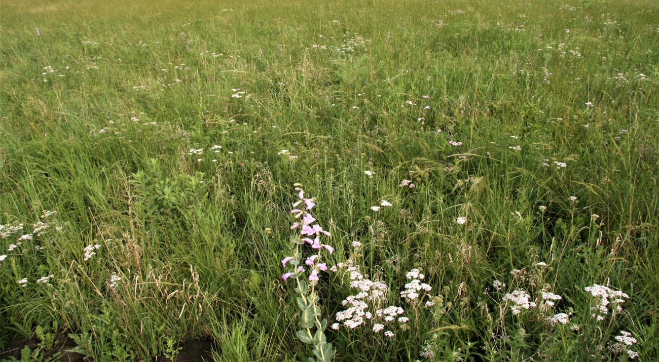
USFWS. Illustrative North American prairie photograph; not the Mozambique study site or termite mounds. · Public domain — U.S. Fish & Wildlife Service media asset. · Rights: Public domain

Termite mounds preserve bird diversity pockets even where savanna became farmland

Mozambique field counts find that tiny structures within a landscape can matter as much as the land-cover label.

Evidence
Peer-reviewed
Geography
Gorongosa National Park and agricultural buffer, Mozambique
System
Savanna / grassland / agriculture

WHAT THE EVIDENCE SAYS

Researchers surveyed birds at 160 dry-season sites in Acacia savanna, saline grassland and farms. Termite-mound vegetation had higher bird richness and density than the surrounding matrix in all land uses, including agriculture. Mound bird communities resembled each other across land uses, while some natural-savanna matrix specialists disappeared from farms.

WHY IT MATTERS / OUR READ

Land cover alone hides microhabitat structure. Land managers should survey and conserve vegetated mounds and other ecological islands, but that does not replace the natural grassland matrix. Protecting one habitat element is not equivalent to preserving the entire community.

CAVEATS / UNCERTAINTY

Observational, dry-season point counts; no experimental mound retention/removal or population viability test. Mound vegetation does not fully compensate for savanna conversion.

SOURCE

Newcombe et al. · Landscape Ecology · Mozambique bird survey
View original evidence ↗

Read the Wild Lands assessment

Japan's inland sea became warmer and clearer, but oxygen followed different paths

Fifty-three years of observations resist one simple coastal recovery narrative.

Evidence
Peer-reviewed
Geography
Seto Inland Sea, Japan
System
Coastal water / fisheries

WHAT THE EVIDENCE SAYS

Fisheries monitoring from 1973 to 2025 found surface and bottom warming of about 1.25°C and 1.03°C per 50 years, respectively. Clarity increased and dissolved inorganic nitrogen fell especially in eastern areas. Bottom oxygen trends varied among sub-basins, increasing in some and declining or lacking a significant trend elsewhere.

WHY IT MATTERS / OUR READ

Clear water is not synonymous with a recovered ecosystem. Coastal plans must track nutrients, temperature, oxygen, hydrological exchange and fishery response at compatible scales instead of treating a single basin average as a verdict.

CAVEATS / UNCERTAINTY

Historical monitoring methods and station coverage changed. The study establishes observed trends, not unique causes of fishery decline or every oxygen change.

SOURCE

Onitsuka et al. · Journal of Oceanography · 53-year monitoring analysis
View original evidence ↗

Read the Wild Lands assessment

Connecting habitat may help native plants without solving alien-plant invasions

Northeastern Italian ecological-network research distinguishes connectivity from fragmentation and community uniqueness.

Evidence
Peer-reviewed
Geography
Friuli Venezia Giulia lowlands, northeastern Italy
System
Ecological networks / woodland / meadows

WHAT THE EVIDENCE SAYS

Sampling 219 plots across 87 nodes in a 298-km² ecological network, researchers counted 443 plant species, 47 alien. Peripheral, less-connected nodes supported high native richness and uniqueness; alien richness depended strongly on land-cover composition and edges, especially within fragmented woods.

WHY IT MATTERS / OUR READ

A green corridor is not automatically a complete conservation gain. Plans should evaluate native and introduced communities, landscape edges and patch position, rather than relying only on structural connectivity scores.

CAVEATS / UNCERTAINTY

Correlational landscape study, not an experiment in adding or removing corridors. Patterns are habitat-dependent and alien-community similarity does not alone prove entire floras homogenized.

SOURCE

Liccari et al. · Landscape Ecology · Italian ecological-network study
View original evidence ↗

Read the Wild Lands assessment

Shark Bay's seabed communities held steadier than its midwater fish

Repeated marine cameras detect change a single protected-area species inventory would miss.

Evidence
Peer-reviewed
Geography
Shark Bay World Heritage Area, Western Australia
System
Marine benthic and pelagic ecology

WHAT THE EVIDENCE SAYS

Four seabed and midwater baited-camera surveys over five years recorded 297 taxa; 272 appeared in seabed samples and 47 in midwater. Both communities changed composition between surveys, but benthic abundance, biomass and body length were broadly stable while pelagic samples increasingly featured more small fish.

WHY IT MATTERS / OUR READ

Protected-area evaluation should repeat sampling of separate habitats, fish sizes and composition. A retained species list can coexist with meaningful structural ecological change.

CAVEATS / UNCERTAINTY

Baited-camera detectability and habitat coverage differ. Fishing pressure is suggested as a possible driver of midwater patterns but was not causally identified.

SOURCE

Clarke et al. · Marine Biodiversity · Shark Bay underwater camera series
View original evidence ↗

Read the Wild Lands assessment

Global Radar

A wider field of view.

  1. Baobab carbon inventories can look strong while young trees are missing

    Ethiopian household surveys and tree plots reveal an ageing population in working lands.

    Evidence
    Peer-reviewed
    Geography
    Kurumuk District, northwestern Ethiopia
    System
    Dryland woodlands and farms

    WHAT THE EVIDENCE SAYS

    In surveys of 352 households and 72 plots, mean living-baobab biomass carbon was highest in homesteads (58.61 Mg C/ha), followed by agricultural parkland (48.15) and woodland (43.51). Juvenile recruitment was poor across land uses and woodlands lacked very large diameter cohorts.

    WHY IT MATTERS / OUR READ

    Standing carbon says little about population replacement. Stewardship should connect regeneration and local land-use pressure with standing-stock measurements and the benefits households receive from baobabs.

    CAVEATS / UNCERTAINTY

    Biomass stocks are not total ecosystem carbon. Neither the surveyed pressures nor the authors' assisted-regeneration recommendations were experimentally evaluated.

    SOURCE

    Abebe and Reda · Discover Sustainability · Ethiopian baobab study
    View original evidence ↗

    Read the Wild Lands assessment
  2. Brazil's landslide scars greened up but scar shape did not explain recovery

    A nine-year satellite record tracks terrain controls and shows the limits of greenness.

    Evidence
    Peer-reviewed
    Geography
    Rolante River basin, Rio Grande do Sul, Brazil
    System
    Landslide disturbance / forest succession

    WHAT THE EVIDENCE SAYS

    Sentinel-2 indices tracked 85 scars from a 2017 rainfall disaster over 2018–2026. Greenness increased fastest early then leveled; slope correlated with vegetation moisture and elevation with bare-soil indices. Circularity, aspect and curvature showed no significant explanatory effects in the models.

    WHY IT MATTERS / OUR READ

    Target persistent bare and low-moisture areas for field checks before assuming a uniform planting prescription. Monitor soil stability and community composition separately from optical cover.

    CAVEATS / UNCERTAINTY

    Satellite greenness is not native forest recovery or slope stabilization. The 85 included scars were a filtered subset of 335 and reflectance plateaus can reflect sensor saturation.

    SOURCE

    Cargnin et al. · Environmental Earth Sciences · Brazilian post-landslide monitoring
    View original evidence ↗

    Read the Wild Lands assessment
  3. Surgeonfish ingest reef sediment without demonstrably grinding it finer

    Functional-group and size differences challenge how reef sediment work is measured.

    Evidence
    Peer-reviewed
    Geography
    Lizard Island area, Great Barrier Reef, Australia
    System
    Coral reef sediment ecology

    WHAT THE EVIDENCE SAYS

    Sampling 98 surgeonfish from 15 species, researchers found sediment intake rose with body size. Brushers and sediment-suckers ingested the most relative to body mass, and larger sediment-suckers led overall intake. Stomach-to-intestine comparisons showed no substantial grain-size modification.

    WHY IT MATTERS / OUR READ

    A reef fish's ecological role may depend on sediment handling rather than just presence. Distinguish the mass ingested from the physical transformations or transport demonstrated by measurements.

    CAVEATS / UNCERTAINTY

    Fish collection and comparisons were limited to sampled species, sites and times; longer evolutionary reconstructions rely on comparative models.

    SOURCE

    Ng et al. · Reviews in Fish Biology and Fisheries · surgeonfish function study
    View original evidence ↗

    Read the Wild Lands assessment
  4. Staying on a flood-prone delta island is neither simply choice nor constraint

    Qualitative research uncovers overlapping strategies behind apparent immobility.

    Evidence
    Peer-reviewed
    Geography
    Mousuni Island, West Bengal, India
    System
    Coastal delta / adaptation governance

    WHAT THE EVIDENCE SAYS

    Interviews on Mousuni Island under cyclones, flooding and erosion distinguish intrinsic reasons to stay, biding time before a possible move, and functional ways of remaining alongside more constrained forms. One household can express several motivations.

    WHY IT MATTERS / OUR READ

    Relocation and flood-protection policy should address people's actual alternatives, land, livelihoods, family roles and attachment to place. Remaining resident does not by itself prove resilience or being trapped.

    CAVEATS / UNCERTAINTY

    Context-specific qualitative research, not a representative population census or tested relocation intervention.

    SOURCE

    Sengupta · Regional Environmental Change · Mousuni interview study
    View original evidence ↗

    Read the Wild Lands assessment
  5. Four South African snakes responded differently to a simulated threatening arm

    Trial context can shape defensive reactions more than a simplistic species reputation.

    Evidence
    Peer-reviewed
    Geography
    South Africa
    System
    Reptile behavior / human-wildlife interface

    WHAT THE EVIDENCE SAYS

    In a small staged encounter, none of 21 Mozambique spitting cobras struck the model arm, while some tested puff adders, black mambas and snouted cobras did. Repeated trials tended to increase defensive responses; escape was common when permitted.

    WHY IT MATTERS / OUR READ

    Wildlife-conflict education should emphasize avoidance and trained response rather than portraying snakes as invariably aggressive. Context matters for risk.

    CAVEATS / UNCERTAINTY

    Small groups, captive or structured trials, and an artificial arm limit conclusions about actual bite rates in the wild.

    SOURCE

    Behavioral Ecology and Sociobiology · four-species snake behavior trial
    View original evidence ↗

    Read the Wild Lands assessment
  6. A sodic-soil bacterium improved crop yields in containers, not yet farms

    Sulfur oxidation and rice-wheat yield shifts warrant cautious follow-up.

    Evidence
    Peer-reviewed
    Geography
    Experimental rice–wheat soils, India
    System
    Working soils / salinity management

    WHAT THE EVIDENCE SAYS

    An Acinetobacter strain increased elemental sulfur oxidation by 3.7–29.4% in tested sodic soils and reduced sodium adsorption ratio by 32–41%. With sulfur, rice and wheat yields were 4.8–19.3% higher than sulfur alone under lysimeter conditions.

    WHY IT MATTERS / OUR READ

    Linked soil chemistry and yield responses are promising for difficult soils, but land managers should await field efficacy and environmental safety tests before applying a live microbial inoculant.

    CAVEATS / UNCERTAINTY

    This was laboratory and lysimeter work, not replicated farm-field validation; the authors request broader phenotypic and genomic biosafety assessment.

    SOURCE

    Sundha et al. · Microbial Ecology · sodic-soil lysimeter work
    View original evidence ↗

    Read the Wild Lands assessment
  7. A river quality model predicts its index better than a simple regression

    High water-index accuracy is not a new independent potability measurement.

    Evidence
    Peer-reviewed
    Geography
    Satluj and Beas rivers, Indian Punjab
    System
    River water-quality monitoring

    WHAT THE EVIDENCE SAYS

    Using measured water chemistry and microbial indicators, researchers compared methods for predicting a calculated water-quality index. A random forest reported R² of 0.97 versus 0.64 for multiple linear regression; dissolved oxygen, biological oxygen demand and coliform variables remained important.

    WHY IT MATTERS / OUR READ

    The practical question is whether quicker data analysis improves sampling and intervention decisions. Water safety requires direct contaminant measurement and proper validation, not a model score.

    CAVEATS / UNCERTAINTY

    The response index is itself calculated from input variables, so fitted accuracy is not independent potability validation and might not transfer to other watersheds.

    SOURCE

    Discover Water · Beas/Satluj water-index model comparison
    View original evidence ↗

    Read the Wild Lands assessment
  8. A bacterial addition improved nitrogen removal inside treatment reactors

    Wastewater process evidence needs downstream ecological validation.

    Evidence
    Peer-reviewed
    Geography
    Experimental activated-sludge system
    System
    Wastewater treatment / nitrogen

    WHAT THE EVIDENCE SAYS

    An experimental activated-sludge system inoculated with Bacillus amyloliquefaciens removed more dissolved organic nitrogen. At the reported optimal 10% inoculation rate, removal of DON, ammonium and total nitrogen was 91.68%, 95.79% and 61.54% respectively.

    WHY IT MATTERS / OUR READ

    Wastewater engineering is ecology upstream: reductions in plant effluent loads may matter for river nutrients, but the link must be followed through operational performance and receiving-water response.

    CAVEATS / UNCERTAINTY

    The report is an early peer-reviewed accepted article, subject to copyediting; reactor results do not establish real-world plant scale, economic feasibility or ecological recovery.

    SOURCE

    Yao et al. · Applied Water Science · nitrogen-reactor experiment
    View original evidence ↗

    Read the Wild Lands assessment
  9. A Gulf of Alaska Pacific cod closure is an allocation decision, not a recovery signal

    NOAA's gear-specific bulletin concerns a quota trigger rather than newly sampled fish.

    Evidence
    Government data
    Geography
    Western Regulatory Area, Gulf of Alaska, United States
    System
    Fisheries management

    WHAT THE EVIDENCE SAYS

    NOAA's October 22 bulletin announced a prohibition on directed Pacific cod fishing by pot gear in the western Gulf of Alaska effective noon local time October 23, to prevent exceeding the 2026 gear-specific allowable-catch allocation.

    WHY IT MATTERS / OUR READ

    A fishery opening or closure has an administrative denominator. Evaluate stock status from population assessments and catch accounting separately from quota triggers.

    CAVEATS / UNCERTAINTY

    Official notice, not an ecological stock assessment. The Federal Register text is legally controlling and should be checked for operational compliance.

    SOURCE

    NOAA Fisheries · Information Bulletin IB 26-50
    View original evidence ↗

    Read the Wild Lands assessment
  10. Synthetic forest images raised classifier accuracy, but no forest recovery was measured

    A reported 98.48% scene-classification score needs spatial validation before ecological use.

    Evidence
    Peer-reviewed
    Geography
    Forest scene dataset, no specific field location
    System
    Forest image classification / monitoring methods

    WHAT THE EVIDENCE SAYS

    A conditional generative image-augmentation pipeline with EfficientNet-B0 reached reported classification accuracy 98.48% on its forest-scene dataset, versus 97.21% for a less optimized conditional model in the author's ablation comparison.

    WHY IT MATTERS / OUR READ

    Classification categories and predictive holdouts are not field ecology. Geography-separated, independently labeled imagery and on-ground verification must precede restoration or habitat-condition claims.

    CAVEATS / UNCERTAINTY

    Only one image dataset was used; the researchers note possible limited generalization to varied real forest and sensor conditions.

    SOURCE

    Lu et al. · Discover Artificial Intelligence · forest scene classifier
    View original evidence ↗

    Read the Wild Lands assessment

Landscape / City Watch

Cities are ecological systems.

Bird diversity in five Andean cities tracked nearby vegetation, not every disturbance indicator

A landscape-design study separates species counts, functional traits and evolutionary distinctiveness.

Evidence
Peer-reviewed
Geography
Bogotá, Tunja, Medellín, Ibagué and Neiva, Colombia
System
Urban greenspaces / avifauna

WHAT THE EVIDENCE SAYS

Across 180 point-count surveys in five Colombian cities, 1,450 birds of 80 species were recorded. Patches closer to vegetation supported higher species richness, abundance and functional diversity. Evolutionary distinctiveness lacked the same detected association with tested environmental metrics.

WHY IT MATTERS / OUR READ

For urban landscape architecture, adjacency and patch connectivity deserve attention, but biodiversity should be measured through several dimensions, not species richness alone.

CAVEATS / UNCERTAINTY

Limited-season surveys and nonrandom patch selection restrict causal claims; a nonsignificant dog or pedestrian variable does not mean disturbance never matters.

SOURCE

Ardila-Villamizar et al. · Urban Ecosystems · five-city avian point counts
View original evidence ↗

Read the Wild Lands assessment

October 25, 2026 · Issue 040

This morning's central finding is that ecosystems can retain a useful fragment of biodiversity while losing the surrounding ecological system. In Mozambique, birds clustered in vegetation on termite mounds even after the savanna around them became cropland—but some open-savanna species were still lost. Japan's five-decade coastal record finds warmer, clearer water and regionally divided oxygen trends. An Italian ecological network holds native plants alongside corridors and edges that can also favor alien plants. In Shark Bay, Australian scientists found that seabed and midwater communities changed differently over five years. Radar moves across Ethiopian baobabs without enough juvenile recruits, Brazilian landslide recovery, reef fish handling sediment, coastal residents deciding whether to stay, freshwater water-quality prediction and the policy versus ecology of fisheries closures. Land Manager Watch asks which measurements reveal continuing invasive-carp occupancy rather than simply a low catch.

Land Manager Watch

Evidence for decisions on land, water and habitat

Peer-reviewed · Ohio River Basin, United States

Invasive carp monitoring must separate upstream spread from local persistence

Ohio River detections show why low catch does not necessarily mean disappearance.

Management read

Build monitoring designs around invasion-front location, habitat-specific detectability, site persistence and changing flow. Repeated low detections require effort-adjusted inference, not an automatic conclusion that control has succeeded.

Caveat / uncertainty: Model estimates for bighead carp are uncertain; the study does not experimentally demonstrate removal efficacy, an invasion stop or absence upstream.

Read the full evidence, caveats & Land Manager analysis →

Editorial thread to watch

The recurring error is substituting one useful indicator for an entire system: a land-cover polygon for microhabitat; clearer water for restored food webs; a green corridor for native ecological function; a fisheries closure for population status; and a satellite index for ecological recovery. Species richness, community composition, resilience, legality of data use and management outcomes are different evidence claims. Good adaptive decisions keep the spatial scale, the counterfactual and the limitations attached to the number.