Skip to content
Ecological Intelligence

Ecological evidence.
Independent perspective.
Explore Wild Lands ↗

Morning Brief Global edition

October 23, 2026 · Issue 038

This morning's strongest results are about the gap between what our maps show and what ecosystems actually do. Boreal caribou can survive better by staying in a familiar low-disturbance range yet face greater danger when that same loyalty keeps them in heavily altered forest. At Placencia, Belize, the mangrove sites chosen by residents offer a different starting point than a national habitat map, although the forecast carbon, fish and tourism benefits remain modeling assumptions. Long-term coastal observations near Tatoosh Island suggest that ocean acidification may constrain diatoms through silicon availability; experiments with Arabian Gulf corals identify steroid production by bacterial symbionts as another easily missed ecological mechanism. Today's Radar extends through freshwater nutrients, family farms, water demand, migratory manta rays, aquaculture infrastructure and monitoring. Our Counter-signal observes native rays hunting in an endangered shark nursery; the Land Manager Watch tests whether a fuel-measuring instrument actually sees the relevant structure.

Land Manager Watch

Evidence for decisions on land, water and habitat

Peer-reviewed · Southwest Iberian Peninsula, Spain

A handheld laser scanner saw woodland fuels a low-cost drone often missed

Twelve Mediterranean oak plots tested canopy-fuel estimates relevant to fire-risk assessment.

Management read

When choosing an inventory method, first identify which canopy or understory metric guides the planned decision. Use ground and handheld validation when a photogrammetric surface model cannot see the variable; choose equipment for measured fitness, not convenience alone.

Caveat / uncertainty: Only 12 plots in specific open Mediterranean woodlands were tested, and the study did not independently validate fire-behavior predictions or any fuel treatment.

Read the full evidence, caveats & Land Manager analysis →

Editorial thread to watch

An occupied range is not necessarily a safe one; a mapped mangrove hectare is not yet a delivered community benefit; measured ocean pH is not the entire nutrient cycle; and counting bacterial symbionts is not the same as understanding their metabolism. Across disciplines, useful decisions require matching each indicator to the process, timescale, actors and implementation constraints. The Radar makes that tangible: irrigation savings and solar-potential figures are modeled rather than achieved; portable eDNA is fast but incomplete; and tree-canopy recognition does not guarantee flowering continuity for specialist visitors. Treat these as working evidence with counter-signals and uncertainty visible—not arguments for inaction or a claim that one model works everywhere.

Priority Reads

The evidence that deserves a closer look.

A caribou's loyalty to home can become a liability after disturbance
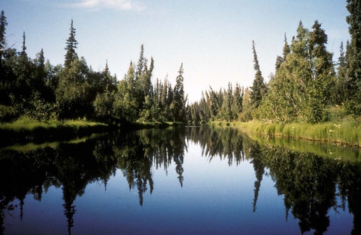
USFWS — illustrative Nowitna National Wildlife Refuge boreal river-and-forest landscape, Alaska; not the Canadian caribou study site. · Public Domain (U.S. Fish & Wildlife Service; verified on source asset page) · Rights: Public domain

A caribou's loyalty to home can become a liability after disturbance

Tracking 331 boreal caribou links site fidelity with survival—but the direction depends on forest disturbance.

Evidence
Peer-reviewed
Geography
Canadian boreal forest
System
Boreal forest / caribou home ranges / fire and harvest

WHAT THE EVIDENCE SAYS

GPS records from 331 boreal caribou across 667,000 square kilometres show that fidelity to familiar low-disturbance ranges was associated with lower mortality. Remaining faithful to severely disturbed ranges, especially regenerating harvest areas, was instead associated with increased mortality; recent forest disturbance also prompted range shifts.

WHY IT MATTERS / OUR READ

Conservation needs to consider the possibility that past habitat familiarity can become a liability. A caribou range remains mapped as occupied even while its function as a safe home deteriorates; connected refuges matter alongside static protection maps.

CAVEATS / UNCERTAINTY

An observational survival and telemetry analysis cannot establish every mortality mechanism or prove that inducing dispersal improves survival.

SOURCE

Landscape Ecology — caribou telemetry research (2026)
View original evidence ↗

Read the Wild Lands assessment

Belize mangrove priorities look different when the community draws the map

Placencia residents identified 83 hectares for restoration and 174 for protection; prospective benefits are modeled, not achieved.

Evidence
Peer-reviewed
Geography
Placencia Lagoon, Belize
System
Mangroves / coastal livelihoods / participatory planning

WHAT THE EVIDENCE SAYS

Five community workshops combined high-resolution habitat baselines and InVEST modeling. The participants prioritized 83 hectares of degraded mangroves for restoration and 174 hectares of healthy stands for protection, with a larger 752-hectare lagoon protection scenario. Researchers modeled possible blue-carbon, spiny lobster, tourism and sociocultural benefits.

WHY IT MATTERS / OUR READ

The useful bridge is between local ecological knowledge, a real map at implementation scale and assumptions financiers can inspect. Community priorities cannot be replaced by national extent maps; plausible benefits still require implementation and monitoring.

CAVEATS / UNCERTAINTY

Modeling assumes restored stands deliver healthy-mangrove benefits after ten years. The estimated carbon, catch and revenue are conditional scenarios, not realized gains or proven investment returns.

SOURCE

Landscape Ecology — Delevaux et al. (2026)
View original evidence ↗

Read the Wild Lands assessment

Ocean acidification may be shifting silicon availability beneath a Pacific food web

Long-term Tatoosh Island observations link falling pH, dissolved silicon and chlorophyll.

Evidence
Peer-reviewed
Geography
Tatoosh Island, Washington, Makah Tribal Nation waters
System
Coastal upwelling / diatoms / dissolved silicon

WHAT THE EVIDENCE SAYS

Two decades of coastal chemistry and plankton measurements showed strong declines in pH, soluble silicon relative to nitrogen and chlorophyll. Models controlling for river flow, upwelling indices and salinity remained consistent with silica-recycling losses associated with acidification.

WHY IT MATTERS / OUR READ

Acidification can potentially affect food webs through nutrient availability, not only the calcification of shells and coral skeletons. Testing the suspected silicon pathway elsewhere could reveal an overlooked productivity constraint.

CAVEATS / UNCERTAINTY

A single well-observed site with statistical models cannot prove pH directly caused the chlorophyll trend, nor establish comparable rates in all oceans.

SOURCE

Nature Communications — Wootton et al. (2026)
View original evidence ↗

Read the Wild Lands assessment

Coral-associated bacteria make steroids that influence their host's heat response

Coral Endozoicomonas bacteria were shown to produce steroid hormones and affect immune signaling in stress experiments.

Evidence
Peer-reviewed
Geography
Saadiyat reef, Arabian Gulf near Abu Dhabi, UAE; laboratory isolates
System
Coral reef microbiomes / thermal stress

WHAT THE EVIDENCE SAYS

Combining sampling of Acropora pharaonis, multi-omics and lab work with three Endozoicomonas isolates, scientists demonstrated bacterial capacity to convert cholesterol to testosterone and progesterone. Immune response assays associated these hormones with pro-survival signaling and reduced inflammatory responses under heat stress.

WHY IT MATTERS / OUR READ

Microbial function may help explain why corals experiencing similar heat differ in their responses. It identifies a mechanistic hypothesis worth testing, not a field-ready remedy.

CAVEATS / UNCERTAINTY

Laboratory metabolism and host signaling results are not evidence that adding these bacteria restores or saves whole reefs.

SOURCE

Nature Microbiology — Mohamed et al. (2026)
View original evidence ↗

Read the Wild Lands assessment

Global Radar

A wider field of view.

  1. Canadian lakes are following opposite phosphorus trajectories

    Modeled Arctic phosphorus increases contrast with declines across several southern watershed classes.

    Evidence
    Peer-reviewed
    Geography
    More than 15,000 Canadian lakes
    System
    Freshwater lakes / watershed nutrients

    WHAT THE EVIDENCE SAYS

    Remote-sensing reconstruction trained with 35,452 field measurements and 386,727 Landsat images estimates 1984–2025 total phosphorus in 15,240 lakes larger than five square kilometres. Arctic tundra lake estimates increased; boreal, temperate, agricultural and urban watershed classes mostly declined.

    WHY IT MATTERS / OUR READ

    National lake averages disguise different watershed mechanisms and may misdirect monitoring effort.

    CAVEATS / UNCERTAINTY

    These are model estimates, not a direct annual water sample at every lake; small lakes were excluded.

    SOURCE

    Communications Earth & Environment — Canadian lake analysis (2026)
    View original evidence ↗

    Read the Wild Lands assessment
  2. Diversified farming was not the only factor tied to smallholder food security

    A Nicaragua cacao-and-coffee survey links diversity to diets, with important roles for water, staples and income.

    Evidence
    Peer-reviewed
    Geography
    Nicaragua: Segovias coffee farms and Waslala cacao farms
    System
    Coffee-cacao farming / livelihood resilience

    WHAT THE EVIDENCE SAYS

    A survey of 429 smallholders plus 13 interviews found crop diversity associated with dietary diversity, whereas staple crop surpluses, household water security, farm size and income also tracked food security. Input and food price inflation were immediate reported concerns.

    WHY IT MATTERS / OUR READ

    Resilience must be evaluated as a livelihood and resource system, not a single agroecological practice.

    CAVEATS / UNCERTAINTY

    Cross-sectional correlations do not prove that diversification alone reduced hunger; cacao and coffee sites have different conditions.

    SOURCE

    Agronomy for Sustainable Development — Bacon and Sundstrom (2026)
    View original evidence ↗

    Read the Wild Lands assessment
  3. Tarim Basin water savings remain a cropping-scenario estimate

    Modeled crop substitution and wider drip irrigation could save blue water in arid northwest China.

    Evidence
    Peer-reviewed
    Geography
    Tarim River Basin, Xinjiang, China
    System
    Irrigation / basin agricultural demand

    WHAT THE EVIDENCE SAYS

    Using crop and climate data from 2000–2020, researchers simulated alternative crop mixes. Their least water-demanding evaluated scenario combined no rice, 10% cotton, 30% wheat and 60% maize, yielding an estimated 965 million cubic metres of potential savings; drip irrigation could add another modeled increment.

    WHY IT MATTERS / OUR READ

    Farm economics, crop viability, water allocation and actual withdrawal monitoring determine whether modeled savings are achievable.

    CAVEATS / UNCERTAINTY

    This is a modeled scenario, not an observed reduction in withdrawals or a verified policy outcome.

    SOURCE

    Applied Water Science — Lin et al. (2026)
    View original evidence ↗

    Read the Wild Lands assessment
  4. Tracked manta rays ignore national boundaries

    Young giant mantas remained near coastal habitats while tracked adults often migrated across jurisdictions.

    Evidence
    Peer-reviewed
    Geography
    Eastern Tropical Pacific off Central America, including Costa Rica and Cocos Island
    System
    Oceanic megafauna / shelf connectivity

    WHAT THE EVIDENCE SAYS

    Researchers combined 59 acoustic tags, 12 satellite tags and photographic identification. Among the analysed adult movement subset, 75% crossed jurisdictional boundaries; immature cohorts made greater use of nearshore habitat.

    WHY IT MATTERS / OUR READ

    Fixed protected areas need both local nursery protection and collaboration over adult migrations.

    CAVEATS / UNCERTAINTY

    Tag coverage and the adult subset limit what can be inferred about the entire giant manta population.

    SOURCE

    Frontiers in Fish Science — manta ray telemetry (2026)
    View original evidence ↗

    Read the Wild Lands assessment
  5. Solar canopies over aquaculture ponds have theoretical energy potential

    A satellite-and-energy model estimates large electrical output under substantial pond coverage.

    Evidence
    Peer-reviewed
    Geography
    Global freshwater aquaculture, existing installations concentrated in China
    System
    Aquaculture ponds / photovoltaics / food-energy use

    WHAT THE EVIDENCE SAYS

    Researchers mapped about 423 square kilometres of aquavoltaics in 2023, overwhelmingly in China, and simulated 40% photovoltaic coverage across suitable pond clusters. That hypothetical deployment yielded about 4,143 TWh annually.

    WHY IT MATTERS / OUR READ

    Evaluate future installations for pond ecology, husbandry, hydrology and local grid emissions, not only potential kilowatt-hours.

    CAVEATS / UNCERTAINTY

    Projected output is technical potential, not operational power generation or verified carbon offsets; ecological tradeoffs require testing.

    SOURCE

    Nature Food — Xia et al. (2026)
    View original evidence ↗

    Read the Wild Lands assessment
  6. Northeast Brazil drought projections emphasize longer episodes

    Across 82 hydrographic microregions, projected dry sequences become more persistent even when local trends are uneven.

    Evidence
    Peer-reviewed
    Geography
    Northeastern Brazil
    System
    Watershed drought / precipitation extremes

    WHAT THE EVIDENCE SAYS

    Bias-corrected CMIP6 simulations using a fixed historical SPI baseline suggest more moderate dry years and longer, more severe drought sequences across many of 82 microregions, especially under higher-emissions scenarios.

    WHY IT MATTERS / OUR READ

    A reservoir or watershed plan must track persistence, duration and spatial coincidence, not just drought-event counts.

    CAVEATS / UNCERTAINTY

    Precipitation-based scenarios are not forecasts of exact local streamflow or groundwater and carry model variation.

    SOURCE

    Natural Hazards — Rolim et al. (2026)
    View original evidence ↗

    Read the Wild Lands assessment
  7. Portable eDNA sequencing worked—but missed much of the known fish diversity

    Field analysis in Norway identified 26 fish and ray species compared with 51–65 in previous surveys.

    Evidence
    Peer-reviewed
    Geography
    Oslofjord, Norway; portable field training also in Brazil
    System
    Marine fish monitoring / portable metabarcoding

    WHAT THE EVIDENCE SAYS

    BentoLab and MinION equipment supported sampling-to-analysis outside a conventional laboratory within roughly five days. Seven samples returned 26 species after manual review of database misidentifications, compared with 51–65 reported by earlier local studies.

    WHY IT MATTERS / OUR READ

    Deployable molecular methods expand access but faster results cannot replace representative sampling and reference quality.

    CAVEATS / UNCERTAINTY

    Limited replication, primer selection, sequencing errors and no field blanks restrict accuracy claims; detection probability was not equivalent across studies.

    SOURCE

    Hydrobiologia — Mauvisseau et al. (2026)
    View original evidence ↗

    Read the Wild Lands assessment
  8. Polish soils supply water and carbon-related functions together

    Agricultural soil indicators covary with texture, carbon stocks, vegetation and water storage.

    Evidence
    Peer-reviewed
    Geography
    Agricultural landscapes, Poland
    System
    Farmland soils / water retention / regulating services

    WHAT THE EVIDENCE SAYS

    National spatial analysis connects soil organic carbon, texture, available water capacity and vegetation density with mapped regulating ecosystem services in agricultural land.

    WHY IT MATTERS / OUR READ

    An isolated soil-service index may miss the interacting properties on which a management decision depends.

    CAVEATS / UNCERTAINTY

    Spatial correlation cannot prove that changing one property automatically improves every other ecological service.

    SOURCE

    Frontiers in Environmental Science — soil services (2026)
    View original evidence ↗

    Read the Wild Lands assessment
  9. Water-use efficiency trends differ within Iran's drylands

    Remote sensing suggests increasing carbon assimilation relative to water loss in some mapped ecosystems.

    Evidence
    Peer-reviewed
    Geography
    Iran: Zagros, Alborz and other modeled zones
    System
    Dryland ecosystems / evapotranspiration

    WHAT THE EVIDENCE SAYS

    A 2001–2025 remote-sensing study mapped valid ecosystem water-use efficiency estimates over about 44% of Iran. Around 23.75% of that valid area showed significant trends, mostly increases; NDVI was an influential predictor in the machine-learning model.

    WHY IT MATTERS / OUR READ

    A higher productivity-to-water-loss ratio does not by itself mean more ecological water is available or that drought risk has declined.

    CAVEATS / UNCERTAINTY

    SHAP contributions are model attributions, not experimentally isolated causes; large portions of the country were not covered by valid estimates.

    SOURCE

    Scientific Reports — Kazemzadeh (2026)
    View original evidence ↗

    Read the Wild Lands assessment
  10. Fossil spores may move the origin of crown land plants

    Reconstructed spore traits suggest a Late Ordovician crown-embryophyte origin.

    Evidence
    Peer-reviewed
    Geography
    Global Paleozoic fossil and phylogenetic record
    System
    Early land plants / paleobotany

    WHAT THE EVIDENCE SAYS

    New ancestral character reconstructions interpret some trilete spores as features of ancient land plants more broadly, rather than uniquely vascular plants. With revised fossil calibration, crown embryophytes are estimated at 457–450 million years ago.

    WHY IT MATTERS / OUR READ

    Even a major ecological transition is dated through contested assumptions about what fossil structures identify.

    CAVEATS / UNCERTAINTY

    Divergence dates depend on fossil calibrations, phylogenies and ancestral-state models, not an observed first plant fossil.

    SOURCE

    Nature Plants — Hooper et al. (2026)
    View original evidence ↗

    Read the Wild Lands assessment

Landscape / City Watch

Cities are ecological systems.

A highly forested tree city still undersupplied specialist flower visitors

Campo Grande has year-round street-tree flowering, but its resource network favors generalized insect visitors.

Evidence
Peer-reviewed
Geography
Campo Grande, Brazil
System
Urban street trees / floral-resource connectivity

WHAT THE EVIDENCE SAYS

A survey of 1,934 trees across 200 blocks found 72% of individual trees were non-native. Flowers and modeled resource connectivity favored small-insect and bee guilds, while some specialist visitors had fewer or more fragmented resources.

WHY IT MATTERS / OUR READ

Urban canopy coverage should be evaluated against phenology and the specific animals it supports, not simply total shade or tree counts.

CAVEATS / UNCERTAINTY

Floral morphology and spatial proxies do not directly establish pollen transfer or trends in pollinator population viability.

SOURCE

Urban Ecosystems — Silva de Carvalho et al. (2026)
View original evidence ↗

Read the Wild Lands assessment

October 23, 2026 · Issue 038

This morning's strongest results are about the gap between what our maps show and what ecosystems actually do. Boreal caribou can survive better by staying in a familiar low-disturbance range yet face greater danger when that same loyalty keeps them in heavily altered forest. At Placencia, Belize, the mangrove sites chosen by residents offer a different starting point than a national habitat map, although the forecast carbon, fish and tourism benefits remain modeling assumptions. Long-term coastal observations near Tatoosh Island suggest that ocean acidification may constrain diatoms through silicon availability; experiments with Arabian Gulf corals identify steroid production by bacterial symbionts as another easily missed ecological mechanism. Today's Radar extends through freshwater nutrients, family farms, water demand, migratory manta rays, aquaculture infrastructure and monitoring. Our Counter-signal observes native rays hunting in an endangered shark nursery; the Land Manager Watch tests whether a fuel-measuring instrument actually sees the relevant structure.

Land Manager Watch

Evidence for decisions on land, water and habitat

Peer-reviewed · Southwest Iberian Peninsula, Spain

A handheld laser scanner saw woodland fuels a low-cost drone often missed

Twelve Mediterranean oak plots tested canopy-fuel estimates relevant to fire-risk assessment.

Management read

When choosing an inventory method, first identify which canopy or understory metric guides the planned decision. Use ground and handheld validation when a photogrammetric surface model cannot see the variable; choose equipment for measured fitness, not convenience alone.

Caveat / uncertainty: Only 12 plots in specific open Mediterranean woodlands were tested, and the study did not independently validate fire-behavior predictions or any fuel treatment.

Read the full evidence, caveats & Land Manager analysis →

Editorial thread to watch

An occupied range is not necessarily a safe one; a mapped mangrove hectare is not yet a delivered community benefit; measured ocean pH is not the entire nutrient cycle; and counting bacterial symbionts is not the same as understanding their metabolism. Across disciplines, useful decisions require matching each indicator to the process, timescale, actors and implementation constraints. The Radar makes that tangible: irrigation savings and solar-potential figures are modeled rather than achieved; portable eDNA is fast but incomplete; and tree-canopy recognition does not guarantee flowering continuity for specialist visitors. Treat these as working evidence with counter-signals and uncertainty visible—not arguments for inaction or a claim that one model works everywhere.