Skip to content
Ecological Intelligence

Ecological evidence.
Independent perspective.
Explore Wild Lands ↗

Morning Brief Global edition

October 28, 2026 · Issue 043

A policy is not a river response, a habitat polygon is not a breeding outcome, and more vegetation is not always more ecosystem function. A 66-year Ruhr River analysis separates shrinking phosphorus inputs from stored soil nutrients. At Cape Lookout, storm-created piping plover habitat nearly doubled between surveyed years without a significant link to chick productivity. Chesapeake Bay seagrass coverage increased by roughly a quarter as modeled sediment carbon barely changed, and a high-elevation forest reburn increased some young stems while shifting species composition. Today's question is not whether intervention matters—it is what the intervention changes, what is actually measured, and how persistent the result will be.

Land Manager Watch

Evidence for decisions on land, water and habitat

Peer-reviewed · Four German agroforestry sites, 2018–2023

Poplar row age changes which alley crops make sense

Winter crops held yields more reliably than spring crops beside older poplar stands.

Management read

Management read: track crop yield by distance from tree rows and adapt crop choice as canopy and coppice age change. Compare winter crops or shorter tree rotations only after pricing grain, wood, operating costs and site-specific objectives.

Caveat / uncertainty: Four sites and selected crops do not determine general economic or ecological superiority; any biodiversity or soil benefits need separate monitoring.

Read the full evidence, caveats & Land Manager analysis →

Editorial thread to watch

The measurable surface of a landscape is not always the process that determines its ecological performance. That distinction appears in wet-grassland bird habitat, mangrove targets, nocturnal insect interactions and urban cooling. It is also practical: Germany's poplar alley-cropping data show crop selection should change as trees age, while Norway's fjord modeling suggests freshwater delivery schedules can matter for oxygen. A credible field assessment combines mapped structure, measured function, management constraints and uncertainty rather than letting one attractive statistic stand for the whole system.

Priority Reads

The evidence that deserves a closer look.

Phosphorus control worked over decades—but the river kept its inherited load
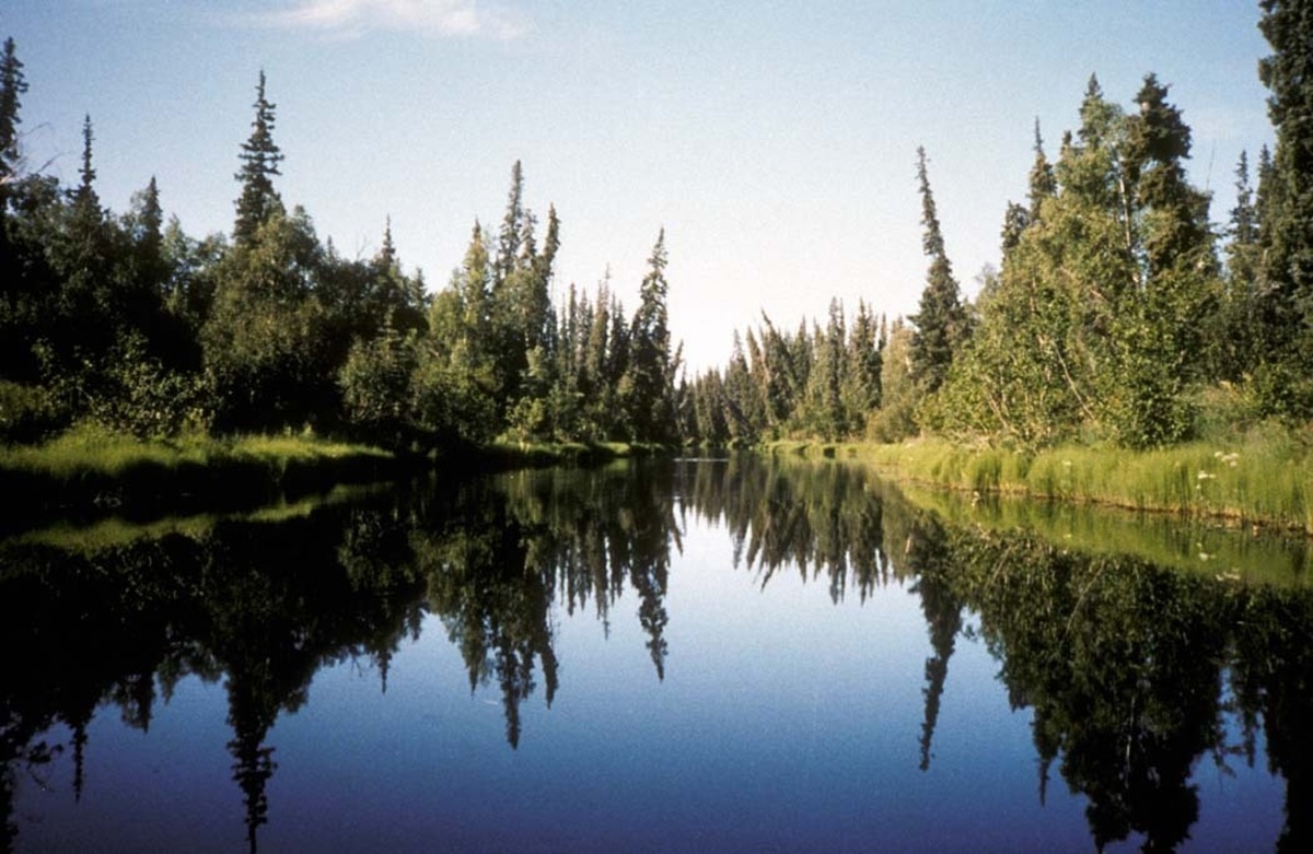
USFWS — illustrative Nowitna National Wildlife Refuge river landscape in Alaska; not the Ruhr River study location · Public domain — U.S. Fish & Wildlife Service · Rights: Public domain

Phosphorus control worked over decades—but the river kept its inherited load

A 66-year Ruhr River analysis separates agricultural source cuts from legacy phosphorus transport.

Evidence
Peer-reviewed
Geography
Ruhr River catchment, Germany, 1957–2023
System
Agricultural river catchment; phosphorus transport

WHAT THE EVIDENCE SAYS

A historical catchment analysis finds mineral-fertilizer phosphorus application began falling in the 1980s, before use-related legislation in 1989. Source controls and better fertilizer practices coincided with near-balanced phosphorus budgets by the late 1990s, but stored soil phosphorus, runoff and erosion remain relevant.

WHY IT MATTERS / OUR READ

Policy timing is not the same as ecological response. Distinguish source cuts, legacy pools and in-stream loads before crediting one program. Keep buffers, source controls and long-term monitoring tied to separate mechanisms.

CAVEATS / UNCERTAINTY

Observational retrospective analysis cannot isolate the causal effect of legislation from changing fertilizer economics, agricultural structure or weather.

SOURCE

Regional Environmental Change (27 Oct 2026)
View original evidence ↗

Read the Wild Lands assessment

More nesting habitat did not predict more piping plover chicks

Cape Lookout habitat fluctuated nearly twofold, but breeding outcomes did not track mapped habitat area.

Evidence
Peer-reviewed
Geography
Cape Lookout National Seashore, North Carolina, USA
System
Barrier island and piping plover nesting habitat

WHAT THE EVIDENCE SAYS

A USGS-linked aerial-imagery, elevation and Bayesian habitat study across six imagery years from 2014 to 2022 found predicted piping plover habitat varied from about 4.56 to 8.31 square kilometers. Habitat often formed on storm overwash/outwash, yet area was not significantly correlated with breeding-pair numbers or chick productivity.

WHY IT MATTERS / OUR READ

A storm can build early-successional habitat as well as remove beach. Management needs direct nesting success, predator, food and heat evidence—not only suitable-habitat polygons.

CAVEATS / UNCERTAINTY

Only six imagery years; non-significant correlations cannot rule out habitat limitation. Population metrics came from existing records and other drivers were not controlled.

SOURCE

Journal of Coastal Conservation — Zeigler et al. (27 Oct 2026)
View original evidence ↗

USGS habitat data release
View supporting source ↗

Read the Wild Lands assessment

Seagrass grew by a quarter, but estimated sediment carbon barely moved

A Chesapeake Bay species shift changed the carbon value of added seagrass cover.

Evidence
Peer-reviewed
Geography
Mobjack Bay, Chesapeake Bay, Virginia, USA
System
Seagrass composition; sediment blue carbon

WHAT THE EVIDENCE SAYS

Researchers sampled 140 sediment cores and modeled historic cover in Mobjack Bay. At equivalent depths Zostera eelgrass stored roughly 31.4 versus Ruppia 25.0 mg carbon per square centimeter. Dense seagrass cover was estimated to rise 25% in 2010–2020 while interpolated sediment carbon rose just 2.6% as species dominance shifted.

WHY IT MATTERS / OUR READ

Map-based habitat gain does not imply equivalent ecosystem service. Carbon accounting needs species, depth, sediment and canopy structure.

CAVEATS / UNCERTAINTY

Carbon changes are spatial estimates from cores and historical interpolation, not measured net carbon flux or universal seagrass coefficients.

SOURCE

Ecosystems (27 Oct 2026)
View original evidence ↗

Read the Wild Lands assessment

A second wildfire can produce more young trees—and a different forest

Short-interval reburns shifted high-elevation regeneration toward pioneering tree species.

Evidence
Peer-reviewed
Geography
High-elevation western North American forest; 1992/2017 fires
System
Subalpine fire recurrence and succession

WHAT THE EVIDENCE SAYS

A field comparison of unburned, once-burned and reburned high-elevation forest found high-severity reburns could support abundant young stems dominated by early colonizers such as lodgepole pine or deciduous trees, with few of the usual shade-tolerant conifers. Understory species did not respond like saplings.

WHY IT MATTERS / OUR READ

Tree counts and greenness alone may disguise a compositional shift. Track identity of regrowth, fire severity and surviving seed-source distance.

CAVEATS / UNCERTAINTY

Single site, early recovery and nonuniform severity effects; permanent state change is not established.

SOURCE

Fire Ecology (27 Oct 2026)
View original evidence ↗

Read the Wild Lands assessment

Global Radar

A wider field of view.

  1. Mangrove ambitions are not hectares already saved

    Modeled 2030 mangrove targets need measured implementation.

    Evidence
    Peer-reviewed perspective
    Geography
    Global mangrove regions
    System
    Mangrove restoration and protection targets

    WHAT THE EVIDENCE SAYS

    A policy perspective estimates 2030 goals could avoid 1,500 square kilometers of mangrove loss, restore 4,000 and add 36,000 under effective and equitable protection.

    WHY IT MATTERS / OUR READ

    Separate the pledge, funded action, community tenure and verified ecological outcome.

    CAVEATS / UNCERTAINTY

    Scenario estimates in a perspective, not realized hectares or established conservation effectiveness.

    SOURCE

    Ambio (27 Oct 2026)
    View original evidence ↗

    Read the Wild Lands assessment
  2. Wet-grassland birds responded to more than patch acreage

    Vegetation structure inside South American patches shaped observed bird abundances.

    Evidence
    Peer-reviewed
    Geography
    Wet grasslands, southeastern South America
    System
    Wet-grassland structure and agricultural matrix

    WHAT THE EVIDENCE SAYS

    Across 60 patches, researchers counted 2,896 birds of 114 species. Models for 46 species often linked bird abundance to within-patch bog vegetation and tall graminoids; area also mattered.

    WHY IT MATTERS / OUR READ

    Maintain vegetation heterogeneity when conserving working-land grasslands rather than relying on total hectares.

    CAVEATS / UNCERTAINTY

    Observational guild-specific associations cannot establish how grazing or restoration changes populations elsewhere.

    SOURCE

    Biodiversity and Conservation (27 Oct 2026)
    View original evidence ↗

    Read the Wild Lands assessment
  3. Brazilian savanna food webs look different at night

    Nighttime surveys doubled detected herbivore richness while network structure remained broadly similar.

    Evidence
    Peer-reviewed
    Geography
    Cerrado savanna, Brazil
    System
    Plant–herbivore interaction networks

    WHAT THE EVIDENCE SAYS

    Sampling 39 insect herbivore morphospecies on 24 plants, researchers found about twice the richness in nighttime versus daytime networks and strong rewiring among plant–insect links.

    WHY IT MATTERS / OUR READ

    Survey hours change the ecological network an observer can see; comparable headline indices can hide changed interactions.

    CAVEATS / UNCERTAINTY

    Local, limited sampling; similar abstract network properties do not demonstrate equal function.

    SOURCE

    Oecologia (27 Oct 2026)
    View original evidence ↗

    Read the Wild Lands assessment
  4. Atlantic Forest cats divided time—but diet was not tested

    Camera traps reveal the temporal niches of jaguar, puma and ocelot in one protected forest.

    Evidence
    Peer-reviewed
    Geography
    Rio Doce State Park, Brazil
    System
    Large-carnivore temporal ecology

    WHAT THE EVIDENCE SAYS

    A survey of 6,618 camera-trap nights found moderate activity overlap among jaguars, pumas and largely nocturnal ocelots, with distinctive overlap against recorded potential prey.

    WHY IT MATTERS / OUR READ

    Predator communities can divide time as well as territory; add temporal data to assessments.

    CAVEATS / UNCERTAINTY

    Temporal overlap does not prove diet, actual predation, or active avoidance; spatial interactions require separate testing.

    SOURCE

    Mammal Research (27 Oct 2026)
    View original evidence ↗

    Read the Wild Lands assessment
  5. Bird nest parasites gave contrasting signals under tree cover

    Fly larvae and mites varied differently across house-wren nesting sectors in Argentina.

    Evidence
    Peer-reviewed
    Geography
    House-wren nesting areas, Argentina
    System
    Avian ectoparasites and nest vegetation

    WHAT THE EVIDENCE SAYS

    Philornis larval loads were higher in exotic-tree habitat than fragmented habitat, whereas nest-mite loads were lower in both native- and exotic-tree habitat than fragmented areas.

    WHY IT MATTERS / OUR READ

    A vegetation change can affect distinct parasite groups differently; one burden metric is not whole-system health.

    CAVEATS / UNCERTAINTY

    Unreplicated habitat sectors and confounded site differences prevent a causal tree-cover claim.

    SOURCE

    Parasitology Research (27 Oct 2026)
    View original evidence ↗

    Read the Wild Lands assessment
  6. Duckweed filtered aquaculture nutrients until copper rose

    Experimental plant treatment performance collapsed at higher copper exposures.

    Evidence
    Peer-reviewed
    Geography
    Jiangsu Province, China — controlled aquaculture-effluent experiment
    System
    Duckweed nutrient treatment and metal stress

    WHAT THE EVIDENCE SAYS

    Lab systems with Spirodela and Lemna showed substantial nutrient reductions at low copper doses, whereas doses at 3 mg/L and above reduced plant vigor and nutrient removal. Spirodela appeared more tolerant.

    WHY IT MATTERS / OUR READ

    Plant-based wastewater treatment has operational chemistry limits, not a universal removal rate.

    CAVEATS / UNCERTAINTY

    Controlled effluent experiments cannot establish field compliance, seasonal durability or safe metal handling.

    SOURCE

    Discover Environment (26 Oct 2026)
    View original evidence ↗

    Read the Wild Lands assessment
  7. Fjord oxygen depends on when freshwater arrives

    Norwegian numerical experiments expose how a continuous flow can disrupt deep-basin exchange.

    Evidence
    Peer-reviewed
    Geography
    Bolstadfjord, western Norway
    System
    Fjord sill exchange and deep-water oxygen

    WHAT THE EVIDENCE SAYS

    Bolstadfjord simulations indicate changing sill depth, external water density and freshwater discharge timing alters deep-basin renewal; a modeled constant regulated release prevented renewal in one scenario.

    WHY IT MATTERS / OUR READ

    Infrastructure water-flow timing and density matter as much as annual volume for coastal ecology.

    CAVEATS / UNCERTAINTY

    Scenario models, not observed new dam or dredging outcomes; site-specific bathymetry limits transfer.

    SOURCE

    Ocean Dynamics (27 Oct 2026)
    View original evidence ↗

    Read the Wild Lands assessment
  8. Iran's field poplar inventory differs from older satellite maps

    A plantation census couples land-cover definitions with ownership and market limitations.

    Evidence
    Peer-reviewed
    Geography
    Gilan Province, Iran
    System
    Poplar plantation spatial inventory and tenure

    WHAT THE EVIDENCE SAYS

    A province-scale census mapped 16,250 poplar sections spanning 12,179 hectares, versus previously published satellite estimates of 40,485–80,783 hectares. An expert survey highlighted fragmentation and trade constraints.

    WHY IT MATTERS / OUR READ

    Field and satellite maps can describe different land classes; economic feasibility also determines adoption.

    CAVEATS / UNCERTAINTY

    Earlier estimates differ in method/date and may not be wrong on the same definition. Purposive expert sampling is not a farmer census.

    SOURCE

    Discover Environment (27 Oct 2026)
    View original evidence ↗

    Read the Wild Lands assessment
  9. Sugarcane fire emissions remain undermeasured in South Africa

    A global review finds uneven geography and coarse assumptions in agricultural smoke inventories.

    Evidence
    Peer-reviewed evidence synthesis
    Geography
    Global sugarcane research, South Africa focus
    System
    Agricultural burning and emissions exposure

    WHAT THE EVIDENCE SAYS

    A systematic review of 177 studies found far more evidence from the United States and Brazil than South Africa; coarse globally calibrated fire inventories can underestimate crop-fire emissions.

    WHY IT MATTERS / OUR READ

    Calibrate burning estimates to local fuels and atmospheric measurements before relying on global inventory totals for exposure decisions.

    CAVEATS / UNCERTAINTY

    Review evidence, not newly measured South African emissions or a universal health-risk effect size.

    SOURCE

    Frontiers in Environmental Science (Oct 2026)
    View original evidence ↗

    Read the Wild Lands assessment
  10. Lagos urban forestry is a governance and maintenance problem too

    Twenty studies find uneven greening benefits and a need for repeatable site-performance indicators.

    Evidence
    Peer-reviewed evidence synthesis
    Geography
    Lagos, Nigeria
    System
    Urban forestry governance and greenspace maintenance

    WHAT THE EVIDENCE SAYS

    A systematic review of 20 studies from 2016–2025 identified uneven green infrastructure access, maintenance gaps and possible links to land administration; it proposes a recurring State of Urban Forestry evidence report.

    WHY IT MATTERS / OUR READ

    Pair planting and canopy metrics with land security, maintenance budgets, accessibility and community validation.

    CAVEATS / UNCERTAINTY

    English-language review excluded AJOL and grey literature and cannot isolate governance causes.

    SOURCE

    Discover Cities (27 Oct 2026)
    View original evidence ↗

    Read the Wild Lands assessment

Landscape / City Watch

Cities are ecological systems.

More urban vegetation can deliver less marginal cooling

Global satellite and weather-station analysis separates greening gains from thermal resilience.

Evidence
Peer-reviewed
Geography
3,806 urban clusters worldwide
System
Urban greening and climate adaptation

WHAT THE EVIDENCE SAYS

A two-decade analysis of 3,806 urban clusters and 4,855 meteorological stations finds cooling returns to added green infrastructure can saturate in the Global North, while many Global South cities lose or fail to gain greenery amid warming.

WHY IT MATTERS / OUR READ

Judge urban landscape investments by actual thermal protection, canopy survival and distribution—not greener pixels alone.

CAVEATS / UNCERTAINTY

Observational, global-scale relationships do not show that individual local plantings cannot cool or establish a causal project effect. Online Oct 20, PNAS issue Oct 27.

SOURCE

PNAS — Leng et al. (20 Oct 2026 online)
View original evidence ↗

Read the Wild Lands assessment

October 28, 2026 · Issue 043

A policy is not a river response, a habitat polygon is not a breeding outcome, and more vegetation is not always more ecosystem function. A 66-year Ruhr River analysis separates shrinking phosphorus inputs from stored soil nutrients. At Cape Lookout, storm-created piping plover habitat nearly doubled between surveyed years without a significant link to chick productivity. Chesapeake Bay seagrass coverage increased by roughly a quarter as modeled sediment carbon barely changed, and a high-elevation forest reburn increased some young stems while shifting species composition. Today's question is not whether intervention matters—it is what the intervention changes, what is actually measured, and how persistent the result will be.

Land Manager Watch

Evidence for decisions on land, water and habitat

Peer-reviewed · Four German agroforestry sites, 2018–2023

Poplar row age changes which alley crops make sense

Winter crops held yields more reliably than spring crops beside older poplar stands.

Management read

Management read: track crop yield by distance from tree rows and adapt crop choice as canopy and coppice age change. Compare winter crops or shorter tree rotations only after pricing grain, wood, operating costs and site-specific objectives.

Caveat / uncertainty: Four sites and selected crops do not determine general economic or ecological superiority; any biodiversity or soil benefits need separate monitoring.

Read the full evidence, caveats & Land Manager analysis →

Editorial thread to watch

The measurable surface of a landscape is not always the process that determines its ecological performance. That distinction appears in wet-grassland bird habitat, mangrove targets, nocturnal insect interactions and urban cooling. It is also practical: Germany's poplar alley-cropping data show crop selection should change as trees age, while Norway's fjord modeling suggests freshwater delivery schedules can matter for oxygen. A credible field assessment combines mapped structure, measured function, management constraints and uncertainty rather than letting one attractive statistic stand for the whole system.