Skip to content
Ecological Intelligence

Ecological evidence.
Independent perspective.
Explore Wild Lands ↗

Morning Brief Global edition

October 31, 2026 · Issue 046

One ecological system can change even when its broad category stays the same. Newly published forest spectroscopy links autumn senescence to canopy nutrient ratios in addition to climate; a light-and-noise meta-analysis finds negative effects from both pollutants but no consistent direction in their interaction. Brazilian termite mounds buffer heat without removing climatic constraints. A June study we had not yet covered shows why an African mine's ecological footprint can extend far beyond the pit itself. Today's management evidence asks where a forest fragmentation risk map is useful—and where field validation must begin.

Land Manager Watch

Evidence for decisions on land, water and habitat

Peer-reviewed · Mizoram state, northeastern India

Mizoram's forest map pinpoints fragmentation exposure, not restoration success

A 2005–2025 susceptibility analysis points managers toward road-accessible and agricultural-edge forests for field checks.

Management read

Use the susceptibility map to prioritize field validation of remaining large forest cores, edge pressure, road-related access and potential corridors. Track observed conversion and habitat quality in candidate priority areas before committing to prescriptions.

Caveat / uncertainty: Susceptibility is not an observed prediction of future deforestation or restoration effectiveness. The model assumes future processes resemble 2005–2025 change, and AUC measures discrimination rather than site-specific management outcomes.

Read the full evidence, caveats & Land Manager analysis →

Editorial thread to watch

The recurring distinction is between a signal and a demonstrated outcome. Pakistan's mapped rock fractures are targets for hydrogeological investigation, not proven water supply; European crop suitability and Yangtze invasion maps are hypotheses, not future harvests or spread. Beijing's biodiversity–carbon association is not yet a measured causal gain, while the Italian design study predicts runoff and cooling benefits rather than reporting constructed performance. The counter-signal is a German fungus assay that does not reliably identify the species it was intended to, and the weak signal asks what non-analog ancient ecosystems mean for our modern baselines.

Priority Reads

The evidence that deserves a closer look.

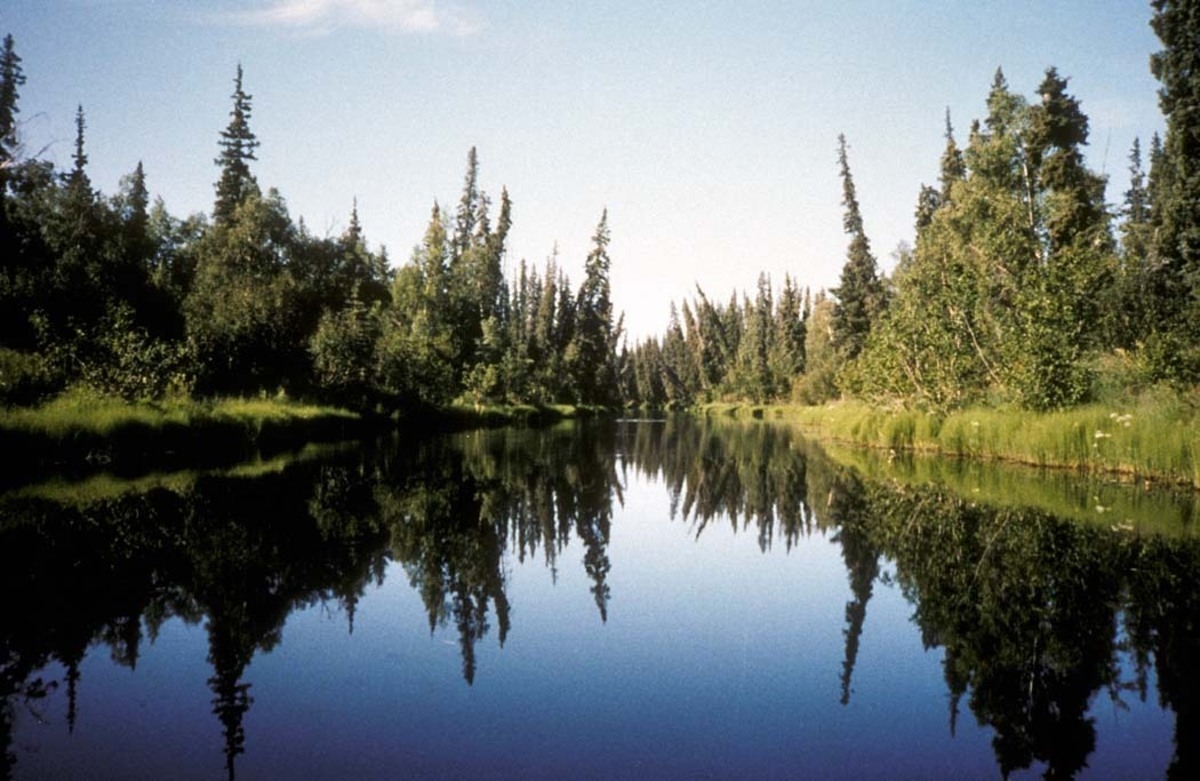
Autumn leaves are reading the nutrient balance, not just the weather
USFWS (illustrative Nowitna NWR, Alaska scene; NOT a NEON study site) · Public domain (USFWS) · Rights: Public domain

Autumn leaves are reading the nutrient balance, not just the weather

Across 25 U.S. forest sites, canopy nitrogen-to-phosphorus and nitrogen-to-potassium ratios helped explain when vegetation senesced.

Evidence
Peer-reviewed
Geography
25 National Ecological Observatory Network forest sites across the United States
System
Forest nutrient balance, phenology and carbon cycling

WHAT THE EVIDENCE SAYS

Airborne spectroscopy and remotely sensed phenology showed earlier senescence associated with higher canopy N:P at 20 of 25 NEON sites. Higher N:K was associated with later senescence across most observed ranges, although individual forests showed reversals or nonlinear responses. Accounting for nutrient ratios improved phenology models beyond climate-only predictors.

WHY IT MATTERS / OUR READ

Growing-season forecasts that treat temperature and rainfall as the whole story can miss a nutrient-mediated signal. For stewardship and long-term forest monitoring, canopy chemistry may help distinguish climate effects from changing nutrient constraints, but it is a diagnostic rather than a fertilization prescription.

CAVEATS / UNCERTAINTY

These are spatial observational associations, not nutrient-addition experiments. The meaning of a high ratio varies by forest and species; the authors identify exceptions, including relatively flat or opposite responses. Their remotely sensed productivity proxy and kilometer-scale climate inputs do not establish plot-level causation.

SOURCE

Nature Communications — Chen et al. (30 Oct 2026)
View original evidence ↗

Read the Wild Lands assessment

Light and noise together were not consistently worse than their sum

A synthesis across taxa found harmful individual disturbance effects but no universal direction for their interaction.

Evidence
Peer-reviewed
Geography
Thirty field/laboratory interaction studies across 13 countries
System
Ecological effects of anthropogenic light and noise

WHAT THE EVIDENCE SAYS

A systematic search retrieved 6,018 records; 30 studies directly examined artificial light at night with anthropogenic noise, with 16 eligible for the interaction meta-analysis. The absolute departure from additivity was detectable, yet the pooled directional interaction was not significant. Both light and noise showed negative main effects, and responses varied among biological outcomes.

WHY IT MATTERS / OUR READ

The design lesson is to examine multiple exposures together without assuming every co-exposure is synergistic. A null directional interaction does not excuse either pollutant; it warns against making a one-size-fits-all claim about their combination.

CAVEATS / UNCERTAINTY

Only 16 papers entered the interaction meta-analysis, with geographic and taxa/outcome imbalance. A significant magnitude of nonadditivity does not imply a consistent worsening; communication outcomes differed from other outcomes, and study designs varied.

SOURCE

Biodiversity and Conservation — 2026 meta-analysis
View original evidence ↗

Read the Wild Lands assessment

A termite mound buffers heat, but not the future climate

Brazilian colonies kept positive modeled thermal safety margins while their physiology and traits remained climate-sensitive.

Evidence
Peer-reviewed
Geography
Nineteen Cornitermes cumulans colonies in São Paulo state, Brazil
System
Savanna termite mounds, thermal physiology and climate risk

WHAT THE EVIDENCE SAYS

Across 19 colonies, the investigators measured worker thermal tolerance and trait variation; internal nest microclimates were monitored in four mounds. Nest temperatures fluctuated less than ambient air, and modeled present-day thermal safety margins remained positive. Warming scenarios projected narrower margins, especially toward lower latitudes, while worker morphology and aspects of gut function varied with climatic gradients.

WHY IT MATTERS / OUR READ

Animals can buffer exposure by constructing habitat without becoming ecologically independent of climate. Conservation and land-use decisions that protect microhabitats still need to consider chronic warming and biological functions beyond simple survival thresholds.

CAVEATS / UNCERTAINTY

Only four mounds had direct temperature time series, while future safety margins are model projections based on assumptions about behavior and physiology. Gut-microbiome associations do not demonstrate effects on colony performance; this is not evidence that all termite species share the same buffer.

SOURCE

Insectes Sociaux — Cornitermes thermal physiology (30 Oct 2026)
View original evidence ↗

Read the Wild Lands assessment

The mine footprint was only a fraction of the forest loss

A continent-scale causal-inference study estimated extensive off-site deforestation around mines across sub-Saharan Africa.

Evidence
Peer-reviewed
Geography
Sub-Saharan Africa; 16,627 mines evaluated over 2001–2020
System
Mining-related deforestation and land-use spillovers

WHAT THE EVIDENCE SAYS

Using land-use change data and difference-in-differences comparisons at 16,627 mines, researchers estimated 187,000 hectares of direct dense-forest loss. They attributed a further 8.0-percentage-point increase in forest clearing within 1 km relative to comparison areas, with effects detectable as far as 20 km. On average, each hectare of directly mined forest was associated with 34 additional hectares of off-site loss within five years.

WHY IT MATTERS / OUR READ

Environmental impact assessments that only map the excavated site can miss the landscape created around it: roads, settlements, agriculture and induced access. This June study is included as an uncovered foundational result, not misrepresented as a new October paper.

CAVEATS / UNCERTAINTY

These are modeled counterfactual estimates from historical satellite land-use data, not direct attribution of every cleared hectare to one operator. Mine types, contexts and spatial/time horizons vary; the 34-to-1 is a continental average, not a universal project multiplier.

SOURCE

Nature — Morton et al. (3 Jun 2026)
View original evidence ↗

Read the Wild Lands assessment

Global Radar

A wider field of view.

  1. Pakistan's fractured aquifers demand more than a promising geological map

    Regional fracture mapping identifies exploration targets, while shared-aquifer governance remains an institutional proposal.

    Evidence
    Peer-reviewed
    Geography
    Northwestern Syntaxis and western lateral margin of Indus Basin, Pakistan
    System
    Fractured-rock groundwater and community water governance

    WHAT THE EVIDENCE SAYS

    Researchers synthesized fracture orientations across 26 structurally defined regions, identifying tectonic settings where secondary permeability could warrant groundwater exploration. They propose pairing hydrogeologic tests with locally governed water allocation and conservation, recognizing that fracture systems may cross surface watersheds or political boundaries.

    WHY IT MATTERS / OUR READ

    Geological connectivity can redefine who is affected by a water decision. Geological screening and community authority are complementary, but neither makes a productive aquifer or an equitable allocation agreement appear automatically.

    CAVEATS / UNCERTAINTY

    No hydraulic connectivity, sustainable yield, water quality or specific well location has been demonstrated by the regional fracture model. The governance design is a proposal, not an evaluated implemented program.

    SOURCE

    Discover Geoscience — Ismat et al. (29 Oct 2026)
    View original evidence ↗

    Read the Wild Lands assessment
  2. Two aquatic invaders may follow different climate trajectories

    Suitability maps suggest expanding golden apple-snail risk but a possible later contraction for water hyacinth in China's Yangtze basin.

    Evidence
    Peer-reviewed
    Geography
    Middle and lower Yangtze River basin, China
    System
    Aquatic invasive species and climate niche modeling

    WHAT THE EVIDENCE SAYS

    MaxEnt suitability models for Pomacea canaliculata and Pontederia crassipes fit observed distributions with test AUCs of about 0.84 and 0.94 respectively. Under SSP2-4.5 and SSP5-8.5, the modeled snail habitat generally expands, whereas water-hyacinth suitability initially expands and then contracts in later periods. Temperature and terrain contributions differ between species.

    WHY IT MATTERS / OUR READ

    Joint invasion plans should not treat all alien aquatic organisms as interchangeable climate winners. Surveillance routes can use species-specific suitability layers as hypotheses, checked against observed spread.

    CAVEATS / UNCERTAINTY

    These are habitat-suitability projections, not observed future invasions. AUC measures discrimination of modeled occurrences rather than validated establishment, and human transport, hydrologic connectivity and biotic interactions remain incompletely modeled.

    SOURCE

    Environmental Earth Sciences — 30 Oct 2026
    View original evidence ↗

    Read the Wild Lands assessment
  3. Urban pigeon injuries in Namibia varied sharply by land use

    Field surveys found foot deformities in 15.3% of 300 pigeons, with the highest proportion in residential areas.

    Evidence
    Peer-reviewed
    Geography
    Katima Mulilo, Namibia; central business, market and residential sites
    System
    Urban wildlife health and anthropogenic debris

    WHAT THE EVIDENCE SAYS

    Researchers visually assessed 300 rock pigeons and found 46 with foot deformities. Prevalence was 22.5% in residential settings, 12.4% in the central business district and 10.4% at markets; residential birds had approximately twice the odds of deformities relative to central-business birds. Fibrous litter was observed as a plausible entanglement exposure.

    WHY IT MATTERS / OUR READ

    Small, chronic injuries can reveal the material ecology of a city. Wildlife-sensitive urban management can be as specific as monitoring and reducing string, thread and similar waste.

    CAVEATS / UNCERTAINTY

    This is a cross-sectional association; researchers did not experimentally trace individual deformities to particular waste items. Odds differences were modest with site and sampling limits, and the findings do not establish a citywide trend.

    SOURCE

    Frontiers in Ecology and Evolution — 29 Oct 2026
    View original evidence ↗

    Read the Wild Lands assessment
  4. Farmland carbon gains in Guanzhong came with a modeled future reversal

    A cropland carbon-balance reconstruction linked regional changes to management and climate, then forecast declining sink capacity.

    Evidence
    Peer-reviewed
    Geography
    Guanzhong region, Shaanxi, China; winter wheat–summer maize systems
    System
    Agricultural net ecosystem productivity and climate projections

    WHAT THE EVIDENCE SAYS

    A study combining a CASA productivity model with estimated heterotrophic soil respiration reconstructed 2000–2023 cropland net ecosystem productivity. The modeled carbon sink fluctuated upward historically, with regional associations involving straw return, fertilizers, irrigation and cropping intensity; CMIP6-based scenarios projected an overall future decrease.

    WHY IT MATTERS / OUR READ

    Historic modeled gains do not guarantee persistent sequestration. Spatial management decisions should distinguish remote-sensing productivity, modeled soil respiration, and direct carbon-stock measurements.

    CAVEATS / UNCERTAINTY

    Net ecosystem productivity was modeled, not directly measured as soil-carbon-stock change. Management associations cannot isolate causality, and future scenarios inherit crop, soil respiration and climate-model uncertainties.

    SOURCE

    Scientific Reports — 30 Oct 2026, accepted peer-reviewed article
    View original evidence ↗

    Read the Wild Lands assessment
  5. Europe's future protein-crop map is not one climate story

    Fine-scale suitability modeling projected gains for legumes but declines for some other crops, with sharp regional variation.

    Evidence
    Peer-reviewed
    Geography
    European agricultural lands under multiple climate scenarios
    System
    Agricultural crop suitability and adaptation geography

    WHAT THE EVIDENCE SAYS

    Species distribution models using climate, soil and topography mapped potential suitability of eight protein-rich crops across Europe at about 1-km resolution. Peas, lupins and faba beans were projected to gain suitable area across many scenarios, while ryegrass and quinoa lost area; soy and oats showed location- and scenario-dependent patterns.

    WHY IT MATTERS / OUR READ

    Climate adaptation is a crop-by-place portfolio problem rather than a promise that every current crop shifts uniformly north. A suitability map can identify questions for cultivar trials and supply-chain planning.

    CAVEATS / UNCERTAINTY

    These are climatic and biophysical suitability scenarios, not observed yield, farm profit, water availability, market adoption or labor feasibility. Crop occurrence records and future climate-model choices shape the outputs.

    SOURCE

    Regional Environmental Change — 29 Oct 2026
    View original evidence ↗

    Read the Wild Lands assessment
  6. South African anti-poaching staff associated community engagement with lower reported poaching

    A 49-practitioner survey adds a governance signal but cannot establish that engagement caused fewer incidents.

    Evidence
    Peer-reviewed
    Geography
    Protected areas in KwaZulu-Natal, Limpopo and Mpumalanga, South Africa
    System
    Protected-area management and human–wildlife relationships

    WHAT THE EVIDENCE SAYS

    Forty-nine conservation practitioners reported their reserves' management practices and whether poaching was a concern. The highest proportion reporting poaching was 84.2% in KwaZulu-Natal; practitioner-reported community engagement was associated with lower odds of reporting poaching after modeled covariates.

    WHY IT MATTERS / OUR READ

    Reserve boundaries are managed social systems as well as ecological ones. The result supports examining the quality of engagement and trust alongside fencing and enforcement, not replacing incident evidence with perception alone.

    CAVEATS / UNCERTAINTY

    Small, non-random practitioner sample; outcome was binary self-reported poaching, not incident counts or an experimental before-and-after estimate. Community engagement might correlate with other better-resourced management practices.

    SOURCE

    Environmental Management — Shivambu et al. (10 Oct 2026)
    View original evidence ↗

    Read the Wild Lands assessment
  7. Seagrass-associated fauna responded to nutrients differently by seascape

    A 16-site British Isles comparison found habitat-context effects and few consistent links to simple seagrass leaf dimensions.

    Evidence
    Peer-reviewed
    Geography
    Sixteen seagrass meadows in lagoon, estuary, coast and island settings around the British Isles
    System
    Seagrass epifauna, nutrient exposure and habitat context

    WHAT THE EVIDENCE SAYS

    Standardized sampling at 16 Zostera marina meadows examined epifaunal richness, abundance and composition against habitat type, seagrass traits and leaf nutrients. Assemblages varied by seascape, with stronger negative nutrient signals in some settings such as lagoons; measured leaf morphology alone did not significantly predict overall richness or abundance in the models.

    WHY IT MATTERS / OUR READ

    Restoration targets that count seagrass cover but ignore associated animals and nutrient context can miss key ecological responses. Marine habitat quality is a community question, not just a vegetation metric.

    CAVEATS / UNCERTAINTY

    Observational cross-site design with four sites per seascape category; some settings were classified pragmatically. Nutrient and faunal relationships are context-dependent, and lack of leaf-trait significance is not proof of zero biological effect.

    SOURCE

    Global Ecology and Conservation — June 2026 field comparison
    View original evidence ↗

    Read the Wild Lands assessment
  8. Legnano's green network has a modeled benefit, not a delivered one

    A peri-urban regeneration framework forecast less runoff and lower heat under proposed land-cover changes.

    Evidence
    Peer-reviewed
    Geography
    Legnano, Lombardy, Italy
    System
    Urban water-sensitive landscape design and scenario modeling

    WHAT THE EVIDENCE SAYS

    Using SWMM stormwater and ENVI-met microclimate models with an urban green-factor index, researchers evaluated converting abandoned or degraded peri-urban land to connected permeable green space. Their modeled scenario reduced runoff volume by roughly 50%, lowered predicted heat by about 1–3°C and raised a green-factor indicator by 0.38.

    WHY IT MATTERS / OUR READ

    Designers can test coupled water, heat and habitat objectives before construction. But a modeled scenario becomes credible ecological performance only after implementation monitoring and maintenance.

    CAVEATS / UNCERTAINTY

    The benefits are model outputs under assumed site design and climatic conditions, not field-verified change. An index increment is not direct measurement of biodiversity gain, and local storm-event conditions may alter realized performance.

    SOURCE

    Landscape and Ecological Engineering — 21 Oct 2026
    View original evidence ↗

    Read the Wild Lands assessment
  9. Two viruses were detected in one bobcat; a new transmission cycle was not

    A wildlife case report documented H5N1 and SARS-CoV-2 co-detection while linking clinical illness to avian influenza.

    Evidence
    Peer-reviewed
    Geography
    Whatcom County, Washington, United States; juvenile bobcat
    System
    Wildlife disease surveillance and One Health interfaces

    WHAT THE EVIDENCE SAYS

    An investigated rehabilitation-admitted bobcat tested positive for HPAI A(H5N1) genotype D1.1 and SARS-CoV-2. Pathology and clinical findings supported H5N1 disease. The case illustrates how integrated mammalian surveillance can detect multiple pathogens in a host rarely subject to routine population-wide monitoring.

    WHY IT MATTERS / OUR READ

    One Health benefits from separating pathogen detection, disease attribution and demonstrated onward transmission. A single unusual host finding can change surveillance questions without proving a broader epidemiological pattern.

    CAVEATS / UNCERTAINTY

    Single opportunistically sampled animal; co-detection does not establish simultaneous active disease from both viruses, their transmission directions, prevalence, reservoir status or spillover to humans.

    SOURCE

    ASM Animal Microbiology — case report (Aug 2026)
    View original evidence ↗

    Read the Wild Lands assessment
  10. The rice–turnip microbiome rotation is a hypothesis awaiting field tests

    A synthesis of saline soils identifies plausible microbial benefits but acknowledges little consistent direct field validation.

    Evidence
    Peer-reviewed
    Geography
    Literature synthesis, saline agricultural landscapes with rice–Brassica rotation relevance
    System
    Saline-soil rehabilitation and rhizosphere microbial functions

    WHAT THE EVIDENCE SAYS

    A review connects salt-tolerant rhizosphere communities to nutrient cycling, osmotic adjustment, microbial biofilms and pathogen suppression. It develops a conceptual framework for rice–turnip rotations but explicitly says evidence for reliable benefits in saline rice systems remains limited.

    WHY IT MATTERS / OUR READ

    A biologically attractive treatment is not yet an established soil-rehabilitation prescription. Pilot trials should measure salinity, crop response, microbial persistence and costs across multiple seasons before scaling.

    CAVEATS / UNCERTAINTY

    This is a synthesis and proposed mechanism, not a new randomized field trial. Long-term validation, persistence of rotation effects and economic viability remain under-evaluated; observational microbial shifts do not demonstrate crop yield gains.

    SOURCE

    Plant Growth Regulation — evidence synthesis (29 Oct 2026)
    View original evidence ↗

    Read the Wild Lands assessment

Landscape / City Watch

Cities are ecological systems.

Beijing's urban biodiversity signal outgrew its green-space footprint

A 12-year district panel associated biodiversity improvement with carbon-sink estimates even where green-area expansion slowed.

Evidence
Peer-reviewed
Geography
Haidian District, Beijing, China; 40 permanent plots in 22 subdistricts
System
Urban biodiversity and carbon-function indicators

WHAT THE EVIDENCE SAYS

From 2014–2025, monitoring at 40 permanent quadrats showed higher recorded plant richness and rising observed bird species counts, alongside a composite biodiversity index associated with urban carbon-sink estimates in mixed models. The authors note that improved acoustic detection contributed to the sharp rise in recorded bird diversity after 2023.

WHY IT MATTERS / OUR READ

Cities should measure species and ecological quality, not mistake greener area alone for function. The key distinction is between a biodiversity–carbon association and proof that adding biodiversity caused a measured amount of sequestration.

CAVEATS / UNCERTAINTY

Single-district observational panel; biodiversity detection methods improved through time, and reported sink capacity involves estimates. Covariate adjustments do not exclude unmeasured urban management or policy confounders.

SOURCE

Urban Ecosystems — Dai et al. (28 Oct 2026)
View original evidence ↗

Read the Wild Lands assessment

October 31, 2026 · Issue 046

One ecological system can change even when its broad category stays the same. Newly published forest spectroscopy links autumn senescence to canopy nutrient ratios in addition to climate; a light-and-noise meta-analysis finds negative effects from both pollutants but no consistent direction in their interaction. Brazilian termite mounds buffer heat without removing climatic constraints. A June study we had not yet covered shows why an African mine's ecological footprint can extend far beyond the pit itself. Today's management evidence asks where a forest fragmentation risk map is useful—and where field validation must begin.

Land Manager Watch

Evidence for decisions on land, water and habitat

Peer-reviewed · Mizoram state, northeastern India

Mizoram's forest map pinpoints fragmentation exposure, not restoration success

A 2005–2025 susceptibility analysis points managers toward road-accessible and agricultural-edge forests for field checks.

Management read

Use the susceptibility map to prioritize field validation of remaining large forest cores, edge pressure, road-related access and potential corridors. Track observed conversion and habitat quality in candidate priority areas before committing to prescriptions.

Caveat / uncertainty: Susceptibility is not an observed prediction of future deforestation or restoration effectiveness. The model assumes future processes resemble 2005–2025 change, and AUC measures discrimination rather than site-specific management outcomes.

Read the full evidence, caveats & Land Manager analysis →

Editorial thread to watch

The recurring distinction is between a signal and a demonstrated outcome. Pakistan's mapped rock fractures are targets for hydrogeological investigation, not proven water supply; European crop suitability and Yangtze invasion maps are hypotheses, not future harvests or spread. Beijing's biodiversity–carbon association is not yet a measured causal gain, while the Italian design study predicts runoff and cooling benefits rather than reporting constructed performance. The counter-signal is a German fungus assay that does not reliably identify the species it was intended to, and the weak signal asks what non-analog ancient ecosystems mean for our modern baselines.